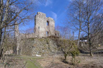
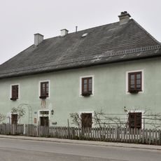
Seisenburg, Castle ruin in Pettenbach, Austria.
Seisenburg is a castle ruin perched at 888 meters elevation in the Austrian mountains, with preserved stone walls from multiple building phases. The remains display features of medieval fortification with later modifications from the early modern period.
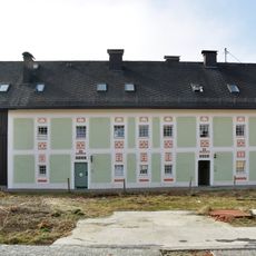
The castle first appeared in written records in 1329 and served the Dukes of Austria as a holding for nearly two centuries. Major renovations in the 17th century transformed its appearance and structure significantly.
The name comes from a noble family that held power here for centuries. The site reflects how castle life shaped the region and what role such fortified places played in local communities.
The site is freely accessible and offers parking for vehicles along with good public transportation connections. Visitors should be prepared for hilly terrain and wear shoes suitable for uneven ground.
A local preservation group actively works on securing and restoring the remaining structures at the site. These ongoing efforts allow visitors to explore the ruins while witnessing how such places are being maintained for future generations.
Location: Pettenbach
Elevation above the sea: 888 m
GPS coordinates: 47.92360,14.03690
Latest update: December 9, 2025 12:21
Pfarrkirche hl. Magdalena, Pettenbach
1.9 km
Gemeindeamt Inzersdorf im Kremstal
3.3 km
Pfarrkirche hl. Benedikt, Pettenbach
4.4 km
Pfarrkirche Viechtwang
5.5 km
Schloss Pettenbach
4.3 km
Filialkirche Inzersdorf im Kremstal
3.4 km
Pfarrkirche Steinbach am Ziehberg
3.6 km
Kath. Filialkirche hl. Leonhard - Heiligenleiten, Pettenbach
3.1 km
Friedhof mit Friedhofskapelle
4.5 km
Spitalskapelle hl. Johannes Nepomuk
5.5 km
Bauernhofanlage Sternberg
5.2 km
Kalkbrennofen, Krapfenmühle
3.9 km
Bildstock, Zöhrböckstraßer Kreuz
4.7 km
Strutzenbauer, Steinbach am Ziehberg
2.9 km
Former sacristan house, Viechtwang 22, Scharnstein
5.5 km
Bürgerhaus, Schmied- oder Lindinger Taverne
4.4 km
Volks- und Hauptschule, exkl. Turnsaal
4.2 km
Pfarrhof
4.5 km
Pfarrhof
1.9 km
Kirchgrabner-Kreuz
3.6 km
Wohnhaus, sog. Krämerhäusl an der Leiten
5.5 km
Schmiede, Schmidten-Haus
4.4 km
Huebmer Eiche
4.6 km
Taverne Gasthof Fleischhauerei Silmbroth
5.6 km
Wohnhaus, ehem. Pfarrspital
5.4 km
Bürgerhaus, Glasererhaus
4.3 km
Rotbuche am Bäckerberg
4.5 km
Kirchenbauerlinde
5.4 kmVisited this place? Tap the stars to rate it and share your experience / photos with the community! Try now! You can cancel it anytime.
Discover hidden gems everywhere you go!
From secret cafés to breathtaking viewpoints, skip the crowded tourist spots and find places that match your style. Our app makes it easy with voice search, smart filtering, route optimization, and insider tips from travelers worldwide. Download now for the complete mobile experience.
A unique approach to discovering new places❞
— Le Figaro
All the places worth exploring❞
— France Info
A tailor-made excursion in just a few clicks❞
— 20 Minutes