Erdfunkstelle Aflenz, Transmitter station in Aflenz, Austria
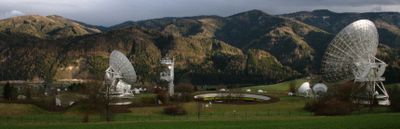
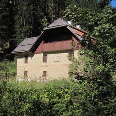
Erdfunkstelle Aflenz is a telecommunications facility in the Austrian Alps where most operational structures are built underground to minimize environmental impact on the mountainous terrain. The station operates large parabolic antennas alongside many smaller ones that handle satellite communications.
The station began operations in 1980 following a design by architect Gustav Peichl, with construction completed after approximately 17 months of work. The project emerged from Austria's need to connect with international satellite communication networks.
This facility represents a key development in how Austria connected with the wider world through technology. It shows the country's commitment to being part of international communication networks across Europe and beyond.
When visiting, remember that the facility sits in a mountainous region with much of its structure underground, so not all components are visible from outside. It is best to contact ahead since this is an active working facility with specific access rules.
The station serves as one of only three calibration centers within the Eutelsat system and houses two massive parabolic antennas roughly 30 meters in diameter. This specialized role gives it particular technical importance for those interested in how satellite communications function.
The community of curious travelers
AroundUs brings together thousands of curated places, local tips, and hidden gems, enriched daily by 60,000 contributors worldwide.