Enable Location

We need your location to show you interesting places around you

Discover nearby places

Find interesting locations and hidden gems around you

Precise directions

Get accurate directions and distances to places

Your location is never shared with other users. It's only used when you tap the location button.

Satkhira District

Log in to your account

Start exploring — it's free

Trusted by 62,555 travelers worldwide

Continue with Google
Continue with Apple
or

We will send you a code to connect

By continuing, you accept our Terms and Conditions and our Privacy Policy

Check your inbox

We've sent a pincode in your inbox. Please enter the code below.

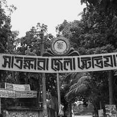
Satkhira District, Administrative district in southwestern Bangladesh.

Satkhira District is an administrative division in southwestern Bangladesh bordering West Bengal, India. The landscape includes multiple river systems and flat agricultural land stretching across the region.

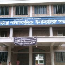
This district was established as a subdivision of Jessore in 1852 and gained independent administrative status in 1984. The change allowed for more focused local governance and development of the expanding region.

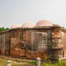
The district population includes 89 percent Muslims and 10 percent Hindus, maintaining traditions through boat races, horse races, and religious festivities throughout the year.

The district is accessible year-round, though seasonal flooding from rivers can affect travel routes. Visiting between October and March provides better road conditions and easier movement through the region.

The region struggles with saltwater infiltration that affects groundwater and surface water quality in many areas. This environmental challenge has pushed farmers to adapt their agricultural methods significantly.

The community of curious travelers

AroundUs brings together thousands of curated places, local tips, and hidden gems, enriched daily by 60,000 contributors worldwide.

Start exploring
Location
Inception
1852
Capital city
Satkhira
Shares border with
Jashore District, Khulna District
GPS coordinates
22.35000,89.08000
Latest update
December 27, 2025 13:15
« Satkhira District - Administrative district in southwestern Bangladesh » is provided by Around Us (aroundus.com). Images and texts are derived from Wikimedia project under a Creative Commons license. You are allowed to copy, distribute, and modify copies of this page, under the conditions set by the license, as long as this note is clearly visible.

Discover hidden gems everywhere you go!

From secret cafés to breathtaking viewpoints, skip the crowded tourist spots and find places that match your style. Our app makes it easy with voice search, smart filtering, route optimization, and insider tips from travelers worldwide. Download now for the complete mobile experience.

Around Us App Screenshot

A unique approach to discovering new places

Le Figaro

All the places worth exploring

France Info

A tailor-made excursion in just a few clicks

20 Minutes

Around Us
Travel Guide & Maps
Download

Send to your phone

QR Code
1

Open the camera app on your mobile.

2

Point at the QR code with your camera. A notification will appear.

3

Tap the notification to open the link.