Belarusian Ridge, Mountain ridge system in northwestern Belarus.
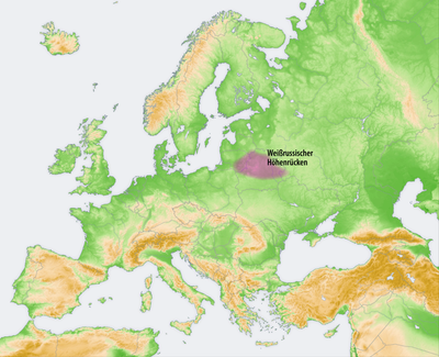
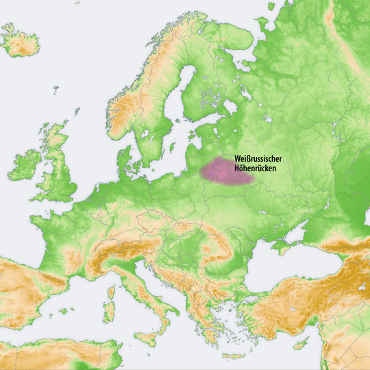
The Belarusian Ridge is a 520 km chain of low, gentle hills running from near Hrodna to Orsha and Vitsebsk, formed by terminal moraines and surfaced with moraine loams. It breaks into separate uplands divided by river valleys, including the Minsk Upland, whose Dzyarzhynskaya Hill reaches 345 m. The ridge continues northeast as the Smolensk-Moscow Upland.
The ridge is a line of terminal moraines left by the ice sheet of the Moscow glaciation, whose maximum extent it marks together with the Smolensk-Moscow Upland. It consists of low, gentle hills resting on the Belarusian crystalline massif. The Berezina and Neman rivers cut through it, and it forms part of the main European watershed between the Baltic and Black seas.
The ridge divides the landscape into two distinct natural zones, shaping how settlements and farms developed on either side. Local communities adapted their way of living to the specific conditions of each region created by this geographical divide.
Multiple hiking trails traverse the ridge sections, connecting different elevated areas and offering access points for exploring nature throughout the year. Conditions vary by season, so visitors should plan accordingly.
The ridge's highest point, Dzyarzhynskaya Hill, reaches 345 metres, not 346. It lies in the Minsk Upland, one of about ten separate uplands that make up the ridge, divided by river valleys such as the Neman and Berezina.
The community of curious travelers
AroundUs brings together thousands of curated places, local tips, and hidden gems, enriched daily by 94,349 contributors worldwide.