Brand-Eiche, hill in Germany
Location: North Rhine-Westphalia
GPS coordinates: 51.11413,7.83638
Latest update: November 16, 2025 05:24
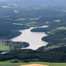
Lister reservoir
2.3 km
Roscheid
2.3 km
Dahlhausen
3.4 km
St. Augustinus
2.8 km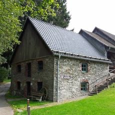
Bone mill
2.4 km
Rautersbeul
3 km
Eckenbach-Quellbäche
2.7 km
Steinbruch Eichen
2 km
Wesebachtal
3 km
Ebbebach-Tal
3.2 km
In der Stesse
3.4 km
LSG-Attendorn-Heggen-Helden <Typ A>
2.2 km
Elmchebach-Tal
2.4 km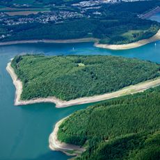
Gilberginsel
3.1 km
Nockel-Berg
3.3 km
Bausen-Berg
1.9 km
Windhagen
1.1 km
Birkeshardt
1.3 km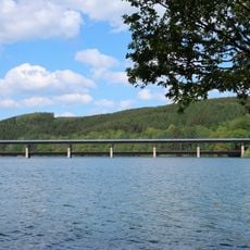
Dumicketal Bridge
3.4 km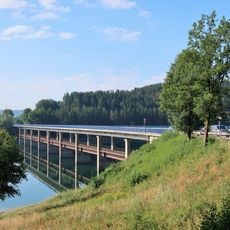
Listertal Bridge
2.5 km
Scenic viewpoint
3.1 km
Wayside shrine
1.4 km
Wayside cross
615 m
Wayside shrine
651 m
Wayside cross
470 m
Magdalenen-Bildstock
1.7 km
Memorial
831 m
Wayside cross
2.2 kmReviews
Visited this place? Tap the stars to rate it and share your experience / photos with the community! Try now! You can cancel it anytime.
Discover hidden gems everywhere you go!
From secret cafés to breathtaking viewpoints, skip the crowded tourist spots and find places that match your style. Our app makes it easy with voice search, smart filtering, route optimization, and insider tips from travelers worldwide. Download now for the complete mobile experience.

A unique approach to discovering new places❞
— Le Figaro
All the places worth exploring❞
— France Info
A tailor-made excursion in just a few clicks❞
— 20 Minutes