Wohnteil des Bauernhauses, building in Vogtareuth, Upper Bavaria, Germany
Location: Vogtareuth
Address: Weikering 7
GPS coordinates: 47.93534,12.17215
Latest update: November 20, 2025 12:26

Schloss Vogtareuth
1.6 km
Schutz der Innauen bei Vogtareuth
1 km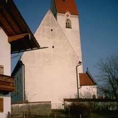
St. Georg
1.5 km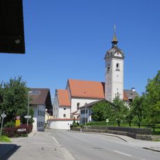
St. Emmeram
1.6 km
Pfarrhof
1.5 km
Stadel
1 km
Stadel
1.5 km
Cultural heritage D-1-8039-0046 in Vogtareuth
551 m
Cultural heritage D-1-8039-0173 in Vogtareuth
1.6 km
Cultural heritage D-1-8039-0168 in Vogtareuth
1.5 km
Schlossökonomie Kirchplatz 8 a in Vogtareuth
1.6 km
Zugehöriger Stadel
693 m
Cultural heritage D-1-8039-0174 in Vogtareuth
1.6 km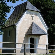
Kapelle St. Franziskus
878 m
Stadel
1.6 km
Stadel
910 m
Friedhofsmauer Kirchplatz 1 in Vogtareuth
1.6 km
Friedhofskapelle Kirchplatz 1 in Vogtareuth
1.6 km
Pfarrhof Rosenheimer Straße 3 in Vogtareuth
1.5 km
Stadel
22 m
Friedhofsmauer Straßkirchen 4 in Vogtareuth
1.5 km
Wayside cross
820 m
Wayside cross
842 m
Catholic church building, wayside cross, Christianity
905 m
Catholic church building, wayside cross, Christianity
1.2 km
War memorial, memorial
1.4 km
Wayside cross
1.4 km
Wayside shrine
1.5 kmReviews
Visited this place? Tap the stars to rate it and share your experience / photos with the community! Try now! You can cancel it anytime.
Discover hidden gems everywhere you go!
From secret cafés to breathtaking viewpoints, skip the crowded tourist spots and find places that match your style. Our app makes it easy with voice search, smart filtering, route optimization, and insider tips from travelers worldwide. Download now for the complete mobile experience.

A unique approach to discovering new places❞
— Le Figaro
All the places worth exploring❞
— France Info
A tailor-made excursion in just a few clicks❞
— 20 Minutes