Stadel, holzbau mit Bundwerk und Hochtenne über massivem Erdgeschoss, Anfang 19. Jh
Location: Riedering
Address: Nähe Stetten
GPS coordinates: 47.82802,12.25275
Latest update: November 20, 2025 12:27

Cultural heritage D-1-8139-0013 in Riedering
1.7 km
Cultural heritage D-1-8139-0014 in Riedering
1.3 km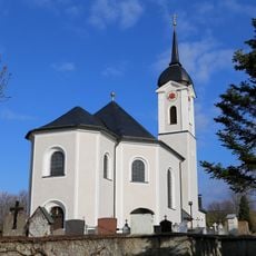
St. Rupert und Martin
861 m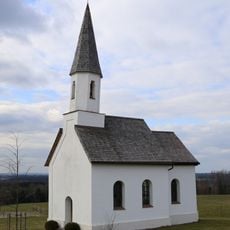
Kapelle Petzgersdorf
2.1 km
Maria Dolorosa
943 m
Cultural heritage D-1-8139-0098 in Riedering
1.5 km
Cultural heritage D-1-8139-0009 in Riedering
1.6 km
Cultural heritage D-1-8139-0148 in Riedering
861 m
Kleinbauernhaus
2 km
Bauernhof
719 m
Backofen
769 m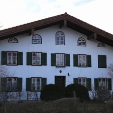
Ehem. Bauernhaus
765 m
Bauernhaus
2.1 km
Bauernhaus
2.1 km
Brechhütte
2.1 km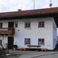
Wohnteil des Bauernhauses
783 m
Bauernhaus
370 m
Kath. Gnadenkapelle St. Maria
1.6 km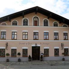
Gasthaus
881 m
Golfanlage Patting-Hochriesblick
1.6 km
Scenic viewpoint
953 m
Wayside cross
2 km
Wayside cross
48 m
Wayside cross
1.6 km
Wayside cross
1.8 km
Wayside cross
2 km
Wayside cross
1.1 km
Wayside cross
658 mReviews
Visited this place? Tap the stars to rate it and share your experience / photos with the community! Try now! You can cancel it anytime.
Discover hidden gems everywhere you go!
From secret cafés to breathtaking viewpoints, skip the crowded tourist spots and find places that match your style. Our app makes it easy with voice search, smart filtering, route optimization, and insider tips from travelers worldwide. Download now for the complete mobile experience.

A unique approach to discovering new places❞
— Le Figaro
All the places worth exploring❞
— France Info
A tailor-made excursion in just a few clicks❞
— 20 Minutes