
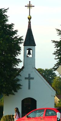
Wegkapelle Mariahilf, building in Kumhausen, Lower Bavaria, Germany
Location: Kumhausen
Address: Eichet
GPS coordinates: 48.51953,12.22521
Latest update: March 3, 2025 15:46
Sender Landshut
4 km
St. Ottilia
3.7 km
Mariä Himmelfahrt (Jenkofen)
1.6 km
St. Laurentius
3.6 km
St. Johann Baptist
638 m
St. Maria (Götzdorf)
3.3 km
St. Stephan
3.2 km
Katholische Kirche Benedikt von Nursia
2 km
St. Jakobus
3.3 km
Kapelle
2 km
Schutz von Landschaftsteilen der Isar-Hangleiten zwischen B 299 neu und Schweinbachtal
3.8 km
Villa Bellevue
4.1 km
Haus Nr. 8 -
3.2 km
Ehemaliges Bauernhaus
2.7 km![Kleinbauernhaus mit Stadel, bekannt als „Trillerhaus“, 1665 als Obereigentum des Klosters Seligenthal erstmals erwähntBilderbuch der Gemeinde Adlkofen: [http://www.adlkofen-bilder.de/index.php?id=399 ''Trillerhaus'']. Online auf adlkofen-bilder.](https://img2.digsty.com/SpWbqNYVUbbbezxAN_Ky-nrJeyln08VMJip3TMoBHU4/rs:fill:230:230:1/g:fp:0.5:0.5/czM6Ly9hcm91bmR1cy8xNC82NzYxNTA2LTVlNDM1M2ZlLkpQRw.jpg)
Kleinbauernhaus mit Stadel, bekannt als „Trillerhaus“, 1665 als Obereigentum des Klosters Seligenthal erstmals erwähntBilderbuch der Gemeinde Adlkofen: [http://www.adlkofen-bilder.de/index.php?id=399 ''Trillerhaus'']. Online auf adlkofen-bilder.
4.1 km
Landshut-Schönbrunn-Einsiedelei
4.1 km
Wohnstallhaus eines ehemaligen Dreiseithofs
3.3 km
Bildstock Maria, Hilfe der Christen
3.6 km
Ehemaliges Wohnstallhaus
2.1 km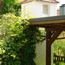
XVII. Burgfriedenssäule
4.1 km
Stadel
2.9 km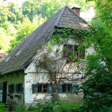
Ehem. Bauernhaus
4 km
VII. Burgfriedenstein
4 km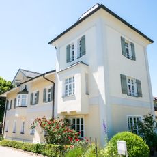
Wohnhaus
533 m
Schmiede
567 m
XVI. Burgfriedenssäule
4 km
Ehemalige Krämerei
4.1 km
Bauernhaus
2.3 kmVisited this place? Tap the stars to rate it and share your experience / photos with the community! Try now! You can cancel it anytime.
Discover hidden gems everywhere you go!
From secret cafés to breathtaking viewpoints, skip the crowded tourist spots and find places that match your style. Our app makes it easy with voice search, smart filtering, route optimization, and insider tips from travelers worldwide. Download now for the complete mobile experience.

A unique approach to discovering new places❞
— Le Figaro
All the places worth exploring❞
— France Info
A tailor-made excursion in just a few clicks❞
— 20 Minutes