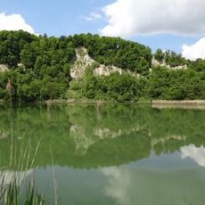
Ehemaliges Bauernhaus, building in Perach, Upper Bavaria, Germany
Location: Perach
Address: Berg 53
GPS coordinates: 48.27671,12.79224
Latest update: November 19, 2025 01:35

Burg Leonberg
1.4 km
Burgstall bei Weingarten
841 m
Abschnittsbefestigung Schmidhub
849 m
Cultural heritage D-1-7742-0039 in Perach
724 m
Katholische Kirche St.Sebastian
1.2 km
Feldkapelle
1.4 km
Wegkapelle
509 m
LSG Dachlwand in den Gemeinden Perach, Schutzing, Marktlberg und dem Markt Marktl, Landkreis Altötting
1 km
Cultural heritage D-1-7742-0072 in Perach
1.3 km
Cultural heritage D-1-7742-0040 in Perach
847 m
Cultural heritage D-1-7742-0218 in Marktl
1.2 km
Scheune Buchholz 74 in Erlbach (Oberbayern)
900 m
Bärenhöhle SE von Altwies
1.4 km
Nebengebäude Buchreit 51 1/3 in Perach
748 m
Friedhofsmauer Leonberg 57 1/3 in Marktl
1.2 km
Vierseithof
1.4 km
Kruzifixus
629 m
Cultural heritage D-1-7742-0038 in Perach
824 m
Gitterbundwerkstadel
229 m
Cultural heritage D-1-7742-0020 in Marktl
1.4 km
Hütte mit Bundwerk-Obergeschoss
757 m
Bauernhaus
1.3 km
Hütte
900 m
Ehemaliges Zuhaus
305 m
Wayside cross
1.4 km
Wayside cross
1.4 km
Wayside cross
1.1 km
Wayside cross
1.3 kmReviews
Visited this place? Tap the stars to rate it and share your experience / photos with the community! Try now! You can cancel it anytime.
Discover hidden gems everywhere you go!
From secret cafés to breathtaking viewpoints, skip the crowded tourist spots and find places that match your style. Our app makes it easy with voice search, smart filtering, route optimization, and insider tips from travelers worldwide. Download now for the complete mobile experience.

A unique approach to discovering new places❞
— Le Figaro
All the places worth exploring❞
— France Info
A tailor-made excursion in just a few clicks❞
— 20 Minutes