
Boundary stone, boundary stone of the Kingdom of Bavaria; stone obelisk; height ca. 2m; damaged on the top; inscriptions: 99, 1818, relief: coat of arms with rhombuses pattern
Location: Beilngries
Part of: political border
GPS coordinates: 49.03763,11.46377
Latest update: March 4, 2025 07:32

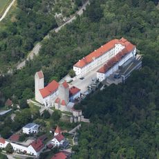
Hirschberg Castle
446 m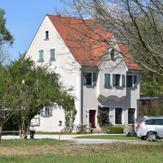
Former operating and residential building of Utzmuehle
546 m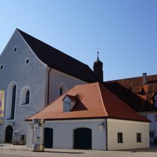
Former Franciscan Monastery
603 m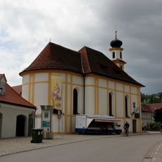
Saint Mary
571 m
Holy Trinity Chapel
74 m
Residential building
634 m
Gate tower
532 m
Former brewery of franciscan monastery
592 m
Ehemalige Steinbrüche am Hirschberg W von Beilngries
637 m
Castle chapel John the Evangelist
426 m
Wayside shrine
599 m
Monastery church St. Trinity
581 m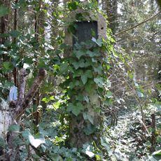
Wayside shrine
645 m
Sühnekreuz Kappenbauerweg
115 m
Ensemble former tax office
494 m
Bergfried
524 m
Former monastery guest house
579 m
Defensive tower of the forecourt
600 m
Defensive tower of the forecourt; coat of arms
636 m
Sauhüterturm
625 m
Befestigungsturm der Vorburg
554 m
Steinkreuz in Hirschberg
574 m
Ensemble former episcopal brewery
131 m
Part of city walls and remains of a defensive tower
624 m
Defensive tower of the forecourt
623 m
City walls section
625 m
Residential building
640 m
Gate portal
531 mReviews
Visited this place? Tap the stars to rate it and share your experience / photos with the community! Try now! You can cancel it anytime.
Discover hidden gems everywhere you go!
From secret cafés to breathtaking viewpoints, skip the crowded tourist spots and find places that match your style. Our app makes it easy with voice search, smart filtering, route optimization, and insider tips from travelers worldwide. Download now for the complete mobile experience.

A unique approach to discovering new places❞
— Le Figaro
All the places worth exploring❞
— France Info
A tailor-made excursion in just a few clicks❞
— 20 Minutes