
Bildstock, bildstock und ehemaliger Grenzstein, sog. Grafenkreuz, aus Rotmarmor, bezeichnet mit dem Jahr 1797
Location: Gars
Address: Lengmooser Straße
GPS coordinates: 48.15449,12.26807
Latest update: November 24, 2025 02:58
Friedhof Kloster-Auer-Straße 3; Nähe Kloster-Auer-Straße in Gars am Inn
608 m
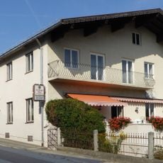
Ehemaliges Bauernhaus
603 m
Kreuzwegstation Urtlleite in Gars am Inn
316 m
Kreuzweg am Weg zur St.-Ulrichs-Kapelle
187 m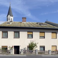
Kreuzwegstation Urtlleite in Gars am Inn
383 m
Kreuzwegstation Urtelfeld in Gars am Inn
600 m
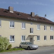
Hofkapelle
473 m
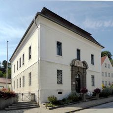
Kirchplatz 2, 4, 6
589 m
Kreuzwegstation In der Flur Grub in Gars am Inn
551 m
Kreuzwegstation Urtelfeld in Gars am Inn
404 m
Kreuzwegstation Urtlleite in Gars am Inn
221 m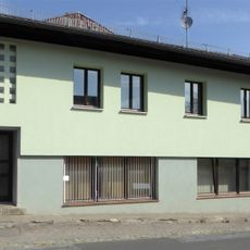
Kreuzwegstation Urtlleite in Gars am Inn
516 m
Kreuzwegstation Urtlleite in Gars am Inn
480 m
Kreuzwegstation Urtlleite in Gars am Inn
440 m
Kreuzwegstation Urtlleite in Gars am Inn
350 m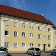
Kreuzwegstation Urtlleite in Gars am Inn
282 m
Kreuzwegstation Urtlleite in Gars am Inn
255 m
Kreuzwegstation Urtelfeld in Gars am Inn
584 mReviews
Visited this place? Tap the stars to rate it and share your experience / photos with the community! Try now! You can cancel it anytime.
Discover hidden gems everywhere you go!
From secret cafés to breathtaking viewpoints, skip the crowded tourist spots and find places that match your style. Our app makes it easy with voice search, smart filtering, route optimization, and insider tips from travelers worldwide. Download now for the complete mobile experience.

A unique approach to discovering new places❞
— Le Figaro
All the places worth exploring❞
— France Info
A tailor-made excursion in just a few clicks❞
— 20 Minutes