, stadel, kleiner Querbau mit Flachsatteldach und eingebautem Blockbau- Getreidekasten über Bruchstein-Erdgeschoss, 18. Jahrhundert
Location: Unterreit
Address: Furth 2
GPS coordinates: 48.11272,12.33318
Latest update: November 24, 2023 20:02

Katholische Filialkirche St. Ulrich
1.8 km
Wallfahrtskapelle Frauenbrünnl
912 m
Cultural heritage D-1-7840-0213 in Unterreit
769 m
Cultural heritage D-1-7840-0229 in Babensham
1.8 km
Friedhofsmauer Stadlern 17 in Babensham
1.8 km
Remise
1.8 km
Cultural heritage D-1-7839-0027 in Unterreit
1.2 km
Wallfahrtskapelle Schlegelberg in Babensham
918 m
Ehemaliges Wohnstallhaus
1.1 km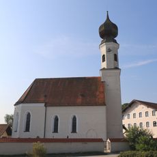
St. Ägidius (Unterreit)
768 m
Gasthaus Maier
1.8 km
Bundwerkstadel
1.8 km
Reiches Bundwerk
1.8 km
Wildfreizeitpark Oberreith
1 km
Rotwild
1.1 km
Schafe
1.1 km
Wayside cross
1.5 km
Wayside cross
1.5 km
Schafe, Ziegen
1 km
Streichelzoo
1 km
Damwild
957 m
Weidenlabyrinth
955 m
Wayside cross
907 m
Greifvogelschau
855 mReviews
Visited this place? Tap the stars to rate it and share your experience / photos with the community! Try now! You can cancel it anytime.
Discover hidden gems everywhere you go!
From secret cafés to breathtaking viewpoints, skip the crowded tourist spots and find places that match your style. Our app makes it easy with voice search, smart filtering, route optimization, and insider tips from travelers worldwide. Download now for the complete mobile experience.

A unique approach to discovering new places❞
— Le Figaro
All the places worth exploring❞
— France Info
A tailor-made excursion in just a few clicks❞
— 20 Minutes