
Bildstock, 19. Jahrhundert; am Gehölzrand, am Weg zum Gehringer Bach
Location: Niederbergkirchen
Address: Wimberg
GPS coordinates: 48.28849,12.53737
Latest update: November 21, 2025 14:23
Herz-Jesu-Kapelle
2.3 km
Nothelferkapelle
1.4 km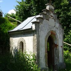
Marienkapelle
1.4 km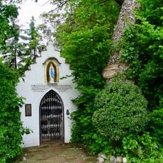
Kapellenneubau von 1983
2 km
Scheune In Ödmühle in Erharting
1.5 km
Wohnstallhaus des ehemaligen Vierseithofes
1.4 km
St. Anton
2.3 km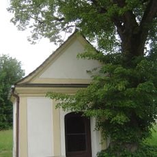
St. Maria
1.5 km
Stadel
1.5 km
Cultural heritage D-1-7741-0242 in Niederbergkirchen
694 m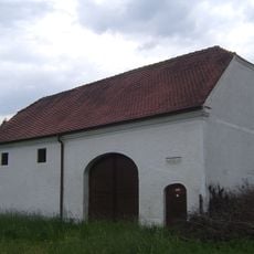
Massiver Stadel
1.5 km
Hauskapelle Oberhofen 3 1/3 in Niederbergkirchen
699 m
Wegkapelle
639 m
Ehemals Gastwirtschaft
2.3 km
Nebengebäude Kleinhiebing 1 in Niederbergkirchen
1.4 km
Kapelle
1.8 km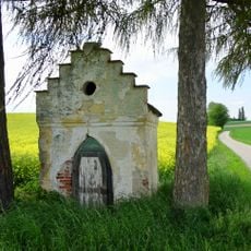
Wegkapelle
1.7 km
Cultural heritage D-1-7741-0105 in Mühldorf am Inn
1.9 km
Ehemaliges Rekonvaleszentenheim des Klosters Raitenhaslach
713 m
Cultural heritage D-1-7741-0053 in Erharting
1.2 km
Stadel
2.1 km
Wayside shrine
2.3 km
Wayside shrine
2 km
Wayside cross
1.3 km
Wayside cross
1.6 km
Wayside cross
708 m
Wayside shrine
1.9 km
Wayside shrine
2 kmReviews
Visited this place? Tap the stars to rate it and share your experience / photos with the community! Try now! You can cancel it anytime.
Discover hidden gems everywhere you go!
From secret cafés to breathtaking viewpoints, skip the crowded tourist spots and find places that match your style. Our app makes it easy with voice search, smart filtering, route optimization, and insider tips from travelers worldwide. Download now for the complete mobile experience.

A unique approach to discovering new places❞
— Le Figaro
All the places worth exploring❞
— France Info
A tailor-made excursion in just a few clicks❞
— 20 Minutes