Stadel, harting; Teilweise verbretterter Ständerbohlenbau mit Flachsatteldach und Bundwerk, erstes Drittel 19. Jahrhundert
Location: Heldenstein
Address: Harting 8
GPS coordinates: 48.24593,12.36940
Latest update: November 22, 2025 07:40
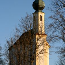
Wallfahrtskirche Maria Schnee (Kirchbrunn)
879 m
Cultural heritage D-1-7740-0054 in Heldenstein
222 m
Cultural heritage D-1-7740-0053 in Heldenstein
748 m
Filialkirche St. Nikolaus
770 m
Brunnenschacht in moderner Einhausung
959 m
Cultural heritage D-1-7740-0272 in Heldenstein
886 m
Cultural heritage D-1-7740-0266 in Heldenstein
1.3 km
Scheune Isenstraße 4 in HeLennstein
553 m
Lourdeskapelle
581 m
Cultural heritage D-1-7740-0207 in Heldenstein
592 m
Wegkapelle
1.6 km
St. Rupert
591 m
Wohnstallhaus
538 m
Cultural heritage D-1-7740-0217 in Heldenstein
777 m
Cultural heritage D-1-7740-0055 in Heldenstein
1.4 km
Kruzifix
964 m
Pfarrhof
518 m
Remise
29 m
Ehemaliges Schulhaus
563 m
Wohnhaus
1.3 km
Wayside cross
441 m
Wayside cross
1 km
Wayside cross
1.1 km
Wayside cross
477 m
Wayside cross
1.1 km
Wayside shrine
435 m
Wayside cross
1.4 km
Catholic church building, wayside cross, Christianity
1.4 kmReviews
Visited this place? Tap the stars to rate it and share your experience / photos with the community! Try now! You can cancel it anytime.
Discover hidden gems everywhere you go!
From secret cafés to breathtaking viewpoints, skip the crowded tourist spots and find places that match your style. Our app makes it easy with voice search, smart filtering, route optimization, and insider tips from travelers worldwide. Download now for the complete mobile experience.

A unique approach to discovering new places❞
— Le Figaro
All the places worth exploring❞
— France Info
A tailor-made excursion in just a few clicks❞
— 20 Minutes