
Marienbildstock, gemauert, 17./18. Jahrhundert
Location: Hirschau
Address: Nähe Kohlberger Straße, an der Kohlberger Straße
GPS coordinates: 49.54602,11.95580
Latest update: November 19, 2025 07:52
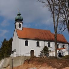
Vierzehn-Nothelfer-Kapelle
421 m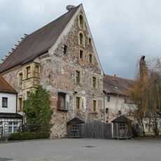
Pflegschloss Hirschau
475 m
Vierzehn-Nothelfer-Kapelle, sogenannte Salvatorkapelle
474 m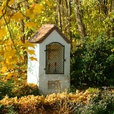
Sogenannte Pestkapelle
440 m
Kapelle des ehemaligen Armenhauses
361 m
Cultural heritage D-3-6437-0050 in Hirschau
657 m
Nebengebäude EhenfeLenr Straße 10 in Hirschau
434 m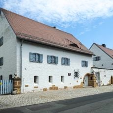
Fernmeldedienstgebäude
585 m
Inschrifttafel
533 m
Cultural heritage D-3-6437-0046 in Hirschau
401 m
Wohnhaus
604 m
Friedhofskreuz Hinter der Kapelle in Hirschau
368 m
Kapelle
414 m
Mauer Josefstraße 22 in Hirschau
591 m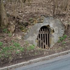
Felsenkelleranlage
440 m
Gasthaus Hauptstraße 1 in Hirschau
502 m
Friedhofsmauer EhenfeLenr Straße 12 in Hirschau
379 m
Grabstätten Hinter der Kapelle in Hirschau
407 m
Cultural heritage D-3-6437-0037 in Hirschau
483 m
Reste der ehemaligen Stadtmauer
593 m
Mälzerei Hauptstraße 2 in Hirschau
461 m
Felsenkeller
447 m
Goldene Straße Nürnberg - Prag
557 m
Catholic church building, wayside cross, Christianity
369 m
Wayside shrine
420 m
Wayside shrine
438 m
Wayside shrine
526 m
Salvatorkapelle
472 mReviews
Visited this place? Tap the stars to rate it and share your experience / photos with the community! Try now! You can cancel it anytime.
Discover hidden gems everywhere you go!
From secret cafés to breathtaking viewpoints, skip the crowded tourist spots and find places that match your style. Our app makes it easy with voice search, smart filtering, route optimization, and insider tips from travelers worldwide. Download now for the complete mobile experience.

A unique approach to discovering new places❞
— Le Figaro
All the places worth exploring❞
— France Info
A tailor-made excursion in just a few clicks❞
— 20 Minutes