Ehemaliges Kammmacherhaus, building in Bad Kötzting, Upper Palatinate, Germany
Location: Bad Kötzting
Address: Ludwigstraße 11
GPS coordinates: 49.17356,12.85811
Latest update: November 15, 2025 05:27

Kirchenburg Kötzting
186 m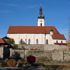
Kirchenburg
69 m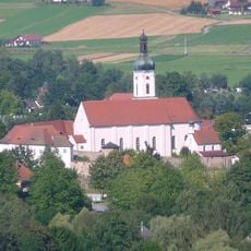
Sogenannte Kirchenburg, ehemaliges Pflegschloss, jetzt Pfarrhof
101 m
Brauerei Herrenstraße 10 in Bad Kötzting
224 m
Burgbefestigung Herrenstraße 11 in Bad Kötzting
64 m
Cultural heritage D-3-6843-0011 in Bad Kötzting
75 m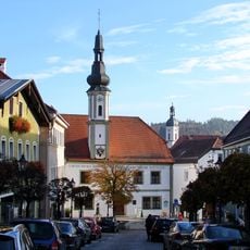
Altes Rathaus
268 m
Brücke Herrenstraße 9 in Bad Kötzting
120 m
Cultural heritage D-3-6843-0004 in Bad Kötzting
261 m
Cultural heritage D-3-6843-0017 in Bad Kötzting
267 m
Cultural heritage D-3-6843-0010 in Bad Kötzting
157 m
Cultural heritage D-3-6843-0002 in Bad Kötzting
189 m
Grabkreuz Herrenstraße 13 in Bad Kötzting
55 m
Burgbefestigung Herrenstraße 11 in Bad Kötzting
70 m
Hausmadonna
163 m
Pfarrhof Herrenstraße 9 in Bad Kötzting
103 m
Pfingstritt-Museum Bad Kötzting
144 m
Graben Nähe Herrenstraße in Bad Kötzting
117 m
Wachturm Herrenstraße 9 in Bad Kötzting
31 m
Scheune Herrenstraße 10 in Bad Kötzting
177 m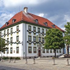
Rathaus
169 m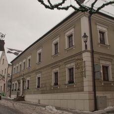
Gasthof Zur Post
196 m
Ehemaliges Amtsgericht
129 m
Kapelle Herrenstraße 13 in Bad Kötzting
47 m
Kreuzträger
34 m
Laternenträger
39 m
Fanfarenbläser
45 m
Geistlicher Offiziator
50 mReviews
Visited this place? Tap the stars to rate it and share your experience / photos with the community! Try now! You can cancel it anytime.
Discover hidden gems everywhere you go!
From secret cafés to breathtaking viewpoints, skip the crowded tourist spots and find places that match your style. Our app makes it easy with voice search, smart filtering, route optimization, and insider tips from travelers worldwide. Download now for the complete mobile experience.

A unique approach to discovering new places❞
— Le Figaro
All the places worth exploring❞
— France Info
A tailor-made excursion in just a few clicks❞
— 20 Minutes