
Stadel, ständerbohlenteil im Obergeschoss, 1. Hälfte 19. Jahrhundert, geziegeltes Erdgeschoss bezeichnet 1937
Location: Triftern
Address: Geretsham 12
GPS coordinates: 48.36267,12.97959
Latest update: June 6, 2025 21:25
Sankt Simon und Judas Thaddäus
8.2 km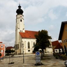
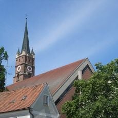
Pfarrkirche Triftern
4.1 km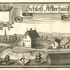
Schloss Afterhausen
7.6 km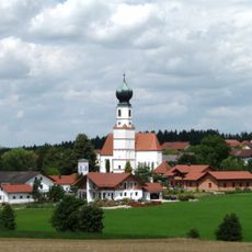
St. Michael
4.8 km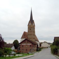
St. Johannis (Neukirchen/Triftern)
2.9 km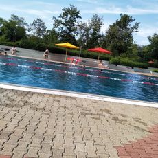
Freibad Pfarrkirchen
7.9 km
Kaser Steinstube
2.2 km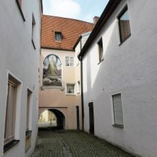
Sog. Glaserhaus
4.1 km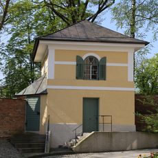
Wachturm Marienplatz in Pfarrkirchen
8.2 km
Katholische Pfarrkirche St. Maria, St. Philipp und St. Jakob
3.6 km
Spitalkirche Heilig Geist
8.1 km
Katholische Filialkirche St. Ägidius
5.4 km
Katholische Kirche St. Koloman
6.6 km
St. Ulrich
8.2 km
Katholische Pfarrkirche St. Maria Patrona Bavariae
2.9 km
Katholische Filialkirche Nikolaus von Myra
7 km
St. Walburga
6.3 km
Katholische Filialkirche Hl. Theresia
5.6 km
St. Stephanus (Reut)
6.4 km
Ehemalige Friedhofs- oder Erasmuskapelle, jetzt Wohnhaus
8.2 km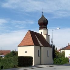
Kapelle
8.1 km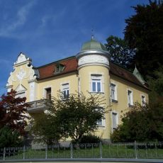
Passauer Straße 77-79
8.2 km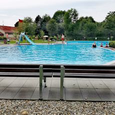
Freibad Triftern
4.5 km
Ensemble Ortskern Triftern
4.1 km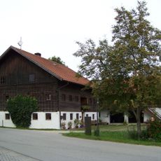
Bauernhaus eines Dreiseithofes
6.6 km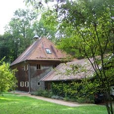
Ehem. Jägerhaus
7.9 km
Holzfigur Johannes Nepomuk
7 km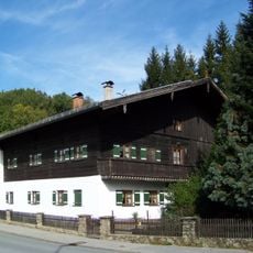
Ehemaliges Bauernhaus
8.1 kmReviews
Visited this place? Tap the stars to rate it and share your experience / photos with the community! Try now! You can cancel it anytime.
Discover hidden gems everywhere you go!
From secret cafés to breathtaking viewpoints, skip the crowded tourist spots and find places that match your style. Our app makes it easy with voice search, smart filtering, route optimization, and insider tips from travelers worldwide. Download now for the complete mobile experience.

A unique approach to discovering new places❞
— Le Figaro
All the places worth exploring❞
— France Info
A tailor-made excursion in just a few clicks❞
— 20 Minutes