Wegkapelle, building in Ering, Lower Bavaria, Germany
Location: Ering
Address: Nähe Sankt-Anna-Straße
GPS coordinates: 48.30088,13.14964
Latest update: November 24, 2023 20:03
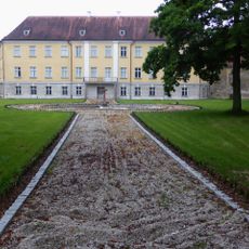
Schloss Ering
213 m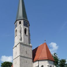
Pfarrkirche Mariä Himmelfahrt (Ering)
261 m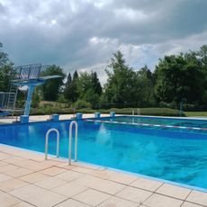
Inntal-Schwimmbad Ering
335 m
Johannes von Nepomuk-Kapelle
444 m
Wunderkapelle
486 m
Brunnen Schloßring 1 in Ering
235 m
Kreuzwegstationen in Ering - St. Anna
108 m
Cultural heritage D-2-7744-0039 in Ering
215 m
Kreuz Schloßring 17 in Ering
287 m
Gasthof zum Steg
198 m
Cultural heritage D-2-7744-0038 in Ering
278 m
Kreuzwegstation Nähe Ering in Ering
516 m
Friedhofsmauer Schloßring 19 in Ering
271 m
Kreuzwegstation Friedhofweg 9 in Ering
193 m
Kleinbauernhaus
479 m
Grabmal Schloßring 17 in Ering
281 m
Ensemble Ortskern Ering
283 m
Kreuzwegstation Sankt-Anna-Straße 19 in Ering
281 m
Gasthof Mayerwirt
293 m
Ehem. Malzfabrik
332 m
Ehem. Verwalterhaus
265 m
Kreuzwegstation Sankt-Anna-Straße in Ering
360 m
Altes Spital
512 m
Schlosspark Nähe Schloßring in Ering
223 m
Wayside shrine
280 m
Wayside shrine
111 m
Kreuzweg
510 m
Wayside shrine
364 mReviews
Visited this place? Tap the stars to rate it and share your experience / photos with the community! Try now! You can cancel it anytime.
Discover hidden gems everywhere you go!
From secret cafés to breathtaking viewpoints, skip the crowded tourist spots and find places that match your style. Our app makes it easy with voice search, smart filtering, route optimization, and insider tips from travelers worldwide. Download now for the complete mobile experience.

A unique approach to discovering new places❞
— Le Figaro
All the places worth exploring❞
— France Info
A tailor-made excursion in just a few clicks❞
— 20 Minutes