Wohnhaus, building in Wittibreut, Lower Bavaria, Germany
Location: Wittibreut
Address: Akazienweg 7; Akazienweg 7 a
GPS coordinates: 48.32773,12.98266
Latest update: November 20, 2025 05:00
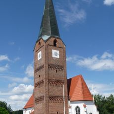
Katholische Pfarrkirche St. Maria, St. Philipp und St. Jakob
456 m
Feldkapelle
1.1 km
Kapelle
1.5 km
Wallfahrtskapelle zum Gnadenbrünnlein
452 m
Wegkapelle
332 m
Tiefbrunnen Teufelseigen 4 in Wittibreut
1.6 km
Wohnhaus Akazienweg 7 a in Wittibreut
27 m
Nebengebäude Hohenthann 8 in Wittibreut
1.6 km
Ehem. Wohnstallhaus eines Vierseithofes
1.3 km
Scheune Imerlsöd 1 in Wittibreut
540 m
Stallstadel Zaun 1 in Wittibreut
1.5 km
Nebengebäude Thal 1 in Wittibreut
1.4 km
Rottaler Bauernhaus eines Vierseithofes
1.6 km
Scheune Imerlsöd 1 in Wittibreut
569 m
Rottaler Bauernhaus eines Vierseithofes
557 m
Wohnstallhaus des Vierseithofes
1.6 km
Cultural heritage D-2-7643-0056 in Wittibreut
457 m
Bauernhaus eines ehem. Dreiseithofes
1.6 km
Kleiner Einfirsthof
1.2 km
Bauernhaus eines ehem. Vierseithofes
1.4 km
Zugehörig Stadel
917 m
Ehem. Wohnstallhaus des Vierseithofes
1.4 km
Scheune Hohenthann 8 in Wittibreut
1.6 km
Wayside cross
582 m
Wayside cross
263 m
Wayside shrine
827 m
Wayside cross
1.6 km
Wayside cross
554 mReviews
Visited this place? Tap the stars to rate it and share your experience / photos with the community! Try now! You can cancel it anytime.
Discover hidden gems everywhere you go!
From secret cafés to breathtaking viewpoints, skip the crowded tourist spots and find places that match your style. Our app makes it easy with voice search, smart filtering, route optimization, and insider tips from travelers worldwide. Download now for the complete mobile experience.

A unique approach to discovering new places❞
— Le Figaro
All the places worth exploring❞
— France Info
A tailor-made excursion in just a few clicks❞
— 20 Minutes