Stadel, ostflügel des Hofes, mit Ständerbohlenwand und flach geneigtem Satteldach, Mitte 19. Jahrhundert
Location: Mitterskirchen
Address: Fraundorf 29
GPS coordinates: 48.34975,12.71727
Latest update: November 19, 2025 01:59

Cultural heritage D-2-7642-0010 in Mitterskirchen
2.2 km
Cultural heritage D-2-7642-0006 in Mitterskirchen
1.1 km
Burgstall Bergham
975 m
Katholische Filialkirche St. Korona und Mariä Himmelfahrt
2.1 km
Katholische Filialkirche Mariä Himmelfahrt
1.7 km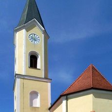
St. Johann Baptist
1.2 km
Wallfahrtskapelle, sog. Bründlkapelle
2.1 km
Cultural heritage D-2-7642-0023 in Mitterskirchen
1.2 km
Cultural heritage D-1-7642-0020 in Pleiskirchen
2.1 km
Scheune Habach 3 in Unterdietfurt
2.4 km
Remise Fraundorf 13 in Mitterskirchen
334 m
Zugehöriger Südflügel
308 m
Ehemalige Remise
2 km
Cultural heritage D-2-7642-0066 in Mitterskirchen
1.7 km
Cultural heritage D-2-7642-0007 in Mitterskirchen
986 m
Ehemaliges Bauernhaus
1.7 km
Firstgedrehtes Stockhaus eines Vierseithofes
339 m
Stadel
228 m
Wohnstallhaus
164 m
Remise Fraundorf 13 in Mitterskirchen
351 m
Einfirsthof
516 m
Wayside shrine
1 km
Wayside shrine
2 km
Christianity, Catholic church building, wayside cross
2 km
Catholic church building, wayside cross, Christianity
1.4 km
Catholic church building, wayside cross, Christianity
1.7 km
Wayside cross
1.3 km
Catholic church building, wayside cross, Christianity
880 mReviews
Visited this place? Tap the stars to rate it and share your experience / photos with the community! Try now! You can cancel it anytime.
Discover hidden gems everywhere you go!
From secret cafés to breathtaking viewpoints, skip the crowded tourist spots and find places that match your style. Our app makes it easy with voice search, smart filtering, route optimization, and insider tips from travelers worldwide. Download now for the complete mobile experience.

A unique approach to discovering new places❞
— Le Figaro
All the places worth exploring❞
— France Info
A tailor-made excursion in just a few clicks❞
— 20 Minutes