
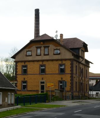
Rumburger Straße 139, administration building in Seifhennersdorf
Location: Seifhennersdorf
Inception: 1890
Made from material: clinker brick
Address: Rumburger Straße 139
GPS coordinates: 50.94184,14.58158
Latest update: March 8, 2025 00:10
Rumburger Straße 127
263 m
Grenzweg 2
64 m
Rumburger Straße 164
103 m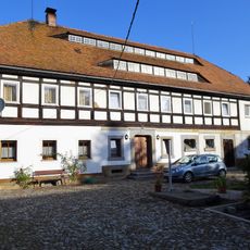
Südstraße 84
159 m
Hohlfeldweg 4
113 m
Grenzweg 3
107 m
Rumburger Straße 158
221 m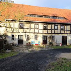
Feldhäuserweg 8
164 m
Rumburger Straße 168
66 m
Hohlfeldweg 8
80 m
Grenzweg 1
47 m
Grunewaldweg 4
285 m
Querstraße 5
325 m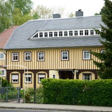
Rumburger Straße 162
143 m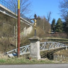
Kříž u podjezdu silnice I/9 v Horním Jindřichově
233 m
Rumburger Straße 137
45 m
Rumburger Straße 135
132 m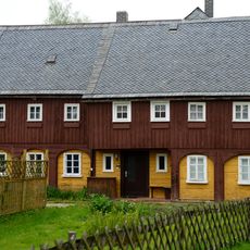
Grunewaldweg 1
287 m
Grunewaldweg 3
278 m
Rumburger Straße 172
25 m
Grunewaldweg 19
100 m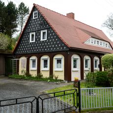
Grunewaldweg 21
71 m
Grunewaldweg 23
68 m
Hohlfeldweg 1
105 m
Hohlfeldweg 2
134 m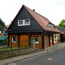
Rumburger Straße 129
226 m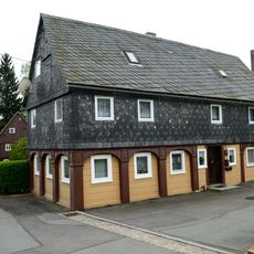
Hohlfeldweg 5
79 m
Rumburger Straße 141
36 mReviews
Visited this place? Tap the stars to rate it and share your experience / photos with the community! Try now! You can cancel it anytime.
Discover hidden gems everywhere you go!
From secret cafés to breathtaking viewpoints, skip the crowded tourist spots and find places that match your style. Our app makes it easy with voice search, smart filtering, route optimization, and insider tips from travelers worldwide. Download now for the complete mobile experience.

A unique approach to discovering new places❞
— Le Figaro
All the places worth exploring❞
— France Info
A tailor-made excursion in just a few clicks❞
— 20 Minutes