Pavillon, bau- und ortsgeschichtlich von Bedeutung. Ehemals Fürst-Otto-Victor-Höhe
Location: Lichtenstein
Inception: 1909
GPS coordinates: 50.75116,12.63822
Latest update: November 17, 2025 18:39

Villa Paul-Zierold-Straße 26
456 m
Wohnhaus in halboffener Bebauung Kirchgasse 19
484 m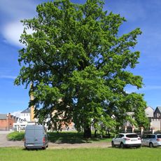
Zierold-Eiche
449 m
Hospital, heute Wohnhaus Hospitalgasse 12
438 m
VEB Strickmoden Elegantia (ehem.) Lichtenstein/Sa.
208 m
Fabrikgebäude Prof.-Dr.-Schneider-Straße 9; 11
381 m
Wohnhaus in geschlossener Bebauung Gottesackergasse 5
413 m
Wohnhaus Gottesackergasse 10
446 m
Gasthaus Rödlitzer Straße 11
239 m
Wohnhaus in geschlossener Bebauung Neumarkt 1
476 m
Hospital, heute Wohnhaus Niclaser Straße 2
242 m
Schule, heute Wohnhaus Kirchplatz 8
483 m
Wohnhaus in halboffener Bebauung Gottesackergasse 2
419 m
Armenhaus, heute Wohnhaus Hartensteiner Straße 40
218 m
Wohnhaus und angebautes Nebengebäude im Hof Kirchplatz 11
440 m
Wohnhaus Kirchplatz 12
457 m
Wohnhaus in geschlossener Bebauung Lößnitzer Straße 20
364 m
Wohnhaus in halboffener Bebauung Kirchgasse 8
451 m
Wohnhaus Kirchgasse 6
473 m
Wohnhaus in geschlossener Bebauung Gottesackergasse 3
418 m
Wohnhaus in geschlossener Bebauung Gottesackergasse 4
412 m
Wohnhaus in halboffener Bebauung Gartenstraße 3a
324 m
Wohnhaus in geschlossener Bebauung Stadtrichter-Werner-Straße 6
467 m
Wohnhaus Zeunerberg 3
482 m
Einzeldenkmale der Sachgesamtheit St.-Laurentius-Friedhof: Leichenhalle, Friedhofskapelle, Friedhofstor sowie Kriegerdenkmal für die Gefallenen des Ersten Weltkrieges, Gräberfeld für während des Zweiten Weltkriegs im Lazarett Verstorbene, Böttge
377 m
Sachgesamtheit St.-Laurentius-Friedhof, mit folgenden Einzeldenkmalen: Leichenhalle, Friedhofskapelle, Friedhofstor sowie Kriegerdenkmal für die Gefallenen des Ersten Weltkrieges, Gräberfeld für während des Zweiten Weltkriegs im Lazarett Verstorb
377 m
Wohnhaus Am Mühlgraben 14
389 m
Villa Chemnitzer Straße 10
463 mReviews
Visited this place? Tap the stars to rate it and share your experience / photos with the community! Try now! You can cancel it anytime.
Discover hidden gems everywhere you go!
From secret cafés to breathtaking viewpoints, skip the crowded tourist spots and find places that match your style. Our app makes it easy with voice search, smart filtering, route optimization, and insider tips from travelers worldwide. Download now for the complete mobile experience.

A unique approach to discovering new places❞
— Le Figaro
All the places worth exploring❞
— France Info
A tailor-made excursion in just a few clicks❞
— 20 Minutes