
LSG-Mechernicher Voreifelland noerdlich Kall, protected area in Germany
Location: Kall
Inception: 2005
GPS coordinates: 50.55767,6.57944
Latest update: November 14, 2025 12:22

St. Apollinaris und Agatha
688 m
St. Dionysius Keldenich
2.2 km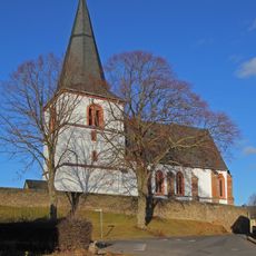
St. Antonius
1.7 km
St. Hubertus
1.7 km
Heideflächen bei Dottel
1.4 km
Kallmuther Berg
1.7 km
Tanzberg
1.9 km
Buntsandsteinrücken nördlich Kall
2.2 km
Tanzberg
1.8 km
Memorial
2.3 km
Isaak Roer
2.4 km
Wayside cross
2.3 km
Wayside cross
2.1 km
Wayside shrine
2.5 km
Kaiserbrunnen
2.3 km
Gedenkstein Bergleute
2.1 km
Esther Bergstein
2.3 km
Isaak Katz
2.3 km
Scenic viewpoint
2.3 km
Jenny Katz
2.3 km
Johanna Katz
2.4 km
Julia Katz
2.4 km
Karola Rosenbaum
2.3 km
Richard Katz
2.3 km
Rosalia Roer
2.4 km
Siegfried Katz
2.4 km
Bench, wayside shrine, Christianity, Catholic church building
2.3 km
Wayside cross
845 mReviews
Visited this place? Tap the stars to rate it and share your experience / photos with the community! Try now! You can cancel it anytime.
Discover hidden gems everywhere you go!
From secret cafés to breathtaking viewpoints, skip the crowded tourist spots and find places that match your style. Our app makes it easy with voice search, smart filtering, route optimization, and insider tips from travelers worldwide. Download now for the complete mobile experience.

A unique approach to discovering new places❞
— Le Figaro
All the places worth exploring❞
— France Info
A tailor-made excursion in just a few clicks❞
— 20 Minutes