
Grünland im Bereich der Herrenwiese nordwestlich Astheim, protected area in the European Union defined by the habitats directive in Hessen, Germany
Location: Trebur
Inception: 2003
GPS coordinates: 49.93967,8.36128
Latest update: November 8, 2025 06:26
Astheim
1.5 km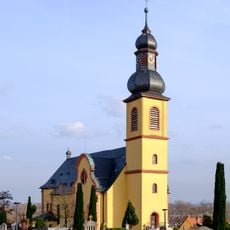
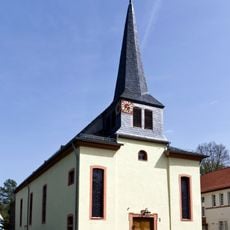
St. Gereon
3 km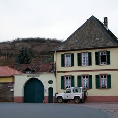
Weingut Gunderloch
3 km
St. Petrus in Ketten (Astheim)
1.7 km
Böhmische Burg Astheim
807 m
Kisselwörth und Sändchen
2.9 km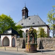
Evangelische Kirche Bauschheim
2.5 km
Riedloch von Trebur
2.8 km
Treburer Unterau
2.7 km
Auenwald Hohenaue
1.7 km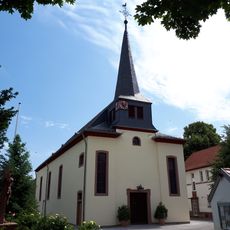
Pfarrkirche St. Petrus in Ketten
1.7 km
NSG Kisselwörth und Sändchen
2.6 km
NSG Kisselwörth und Sändchen
2.8 km
NSG Laubenheimer-Bodenheimer Ried
2.9 km
Mainmündung und Ginsheimer Altrhein
2 km
Ginsheimer Altrhein
1.2 km
Riedloch von Trebur mit angrenzender Fläche
2.5 km
Wayside shrine
1.3 km
Wayside cross, Christianity
3 km
Wayside cross, Christianity
583 m
Anker
2.9 km
1939/45
3 km
Michael Crandall
2.7 km
Christianity, wayside cross
1.3 km
Wayside shrine, Christianity
1.3 km
Memorial, war memorial
1.7 km
Wayside shrine
1.7 km
Wayside shrine, Christianity
1.7 kmReviews
Visited this place? Tap the stars to rate it and share your experience / photos with the community! Try now! You can cancel it anytime.
Discover hidden gems everywhere you go!
From secret cafés to breathtaking viewpoints, skip the crowded tourist spots and find places that match your style. Our app makes it easy with voice search, smart filtering, route optimization, and insider tips from travelers worldwide. Download now for the complete mobile experience.

A unique approach to discovering new places❞
— Le Figaro
All the places worth exploring❞
— France Info
A tailor-made excursion in just a few clicks❞
— 20 Minutes