Fort Hoche, ouvrage de la ceinture fortifiée de Strasbourg (1875-1888)
Location: Strasbourg
Inception: 1879
GPS coordinates: 48.49491,7.76913
Latest update: April 10, 2025 16:45
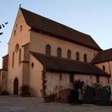
St Trophimus' Church, Eschau
3.9 km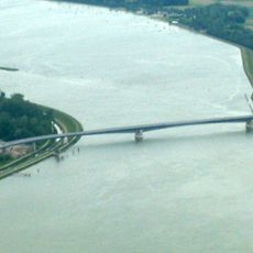
Pierre Pflimlin Bridge
393 m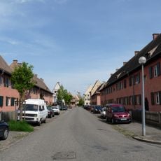
Cité-jardin du Stockfeld
4 km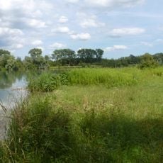
Réserve naturelle nationale de l'île du Rohrschollen
3.1 km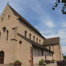
Couvent Saint-Trophime d'Eschau
3.9 km
Plan d'eau de Plobsheim
3.9 km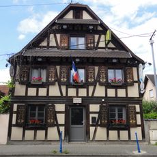
Maison, 38 rue de la Première-Division-Blindée, Eschau
4.1 km
Golf de Strasbourg
2.5 km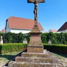
Croix de cimetière à Eschau
3.8 km
Defibrillator
3.6 km
Defibrillator
4 km
Defibrillator
3.3 km
Defibrillator
3.8 km
Defibrillator
3.6 km
Defibrillator
3.7 km
Defibrillator
3.6 km
Defibrillator
4 km
Defibrillator
4 km
Defibrillator
3.4 km
Defibrillator
3.2 km
Defibrillator
4 km
Defibrillator
3.7 km
Defibrillator
3.3 km
Defibrillator
4 km
Defibrillator
2.2 km
Defibrillator
2.3 km
Defibrillator
4 km
Defibrillator
4.1 kmReviews
Visited this place? Tap the stars to rate it and share your experience / photos with the community! Try now! You can cancel it anytime.
Discover hidden gems everywhere you go!
From secret cafés to breathtaking viewpoints, skip the crowded tourist spots and find places that match your style. Our app makes it easy with voice search, smart filtering, route optimization, and insider tips from travelers worldwide. Download now for the complete mobile experience.

A unique approach to discovering new places❞
— Le Figaro
All the places worth exploring❞
— France Info
A tailor-made excursion in just a few clicks❞
— 20 Minutes