
Balatonendréd, village in Hungary
Location: Siófok District
Website: https://balatonendred.hu/
Shares border with: Lulla, Zamárdi, Kőröshegy
Website: https://balatonendred.hu
GPS coordinates: 46.84041,17.97813
Latest update: November 7, 2025 09:24
Böre Castle
5.7 km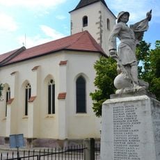
Preĝejo Sankta Kruco (Kőröshegy)
6.1 km
Kő-hegyi kilátó park
4.8 km
Scenic viewpoint
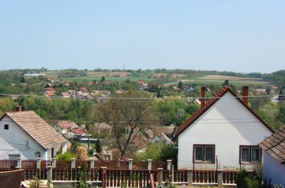
4 km
Baby Teve
5.1 km
Zebrák és Pónik
5.1 km
Elefánt
5.1 km
Vadállatok
5.1 km
Teve
5.1 km
Richter Flórián Cirkusz Park & Resort
5.1 km
Richter Vidámpark
5.1 km
Eselstein
5.1 km
Balaton-Zamárd Emlékkereszt
3.6 km
Gyurgyalag-telep
5.2 km
Lovak
5.1 km
Madárpark
6.9 km
Bohóc
5.1 km
A magyar fájdalom
5.1 km
Nepomuki Szent János
4.8 km
Szentháromság-szobor
361 m
Vaddisznó csapda
7.1 km
Szív-kő
4.8 km
Work of art
7.1 km
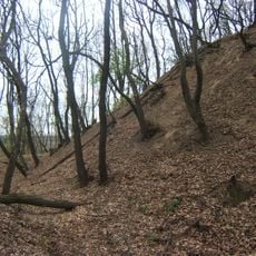
Scenic viewpoint
2.5 km
Samsara Festival
3.9 km
Tóközi madármegfigyelő torony
4.2 km
Scenic viewpoint
4.8 km
Scenic viewpoint
3 kmReviews
Visited this place? Tap the stars to rate it and share your experience / photos with the community! Try now! You can cancel it anytime.
Discover hidden gems everywhere you go!
From secret cafés to breathtaking viewpoints, skip the crowded tourist spots and find places that match your style. Our app makes it easy with voice search, smart filtering, route optimization, and insider tips from travelers worldwide. Download now for the complete mobile experience.

A unique approach to discovering new places❞
— Le Figaro
All the places worth exploring❞
— France Info
A tailor-made excursion in just a few clicks❞
— 20 Minutes