
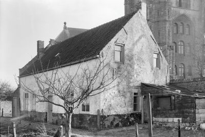
Pand met rechthoekige plattegrond onder zadeldak tussen puntgevels
Pand met rechthoekige plattegrond onder zadeldak tussen puntgevels, Rijksmonument op Wijngaardstraat 23
Location: Veere
Address: Wijngaardstraat 23 4351AP 4351AP
GPS coordinates: 51.54713,3.66641
Latest update: March 22, 2025 16:27

Grote Kerk
60 m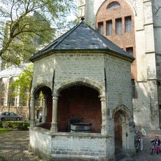
Cisterne
107 m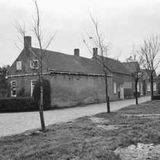
Wagenaarstraat 51, Veere
66 m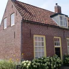
Huis met rechte gevel
83 m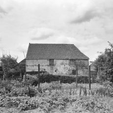
Stadhuisstraat 1, Veere
146 m
Kerkstraat 7, Veere
137 m
Huis met rechte gevel
92 m
Oudestraat 55, Veere
76 m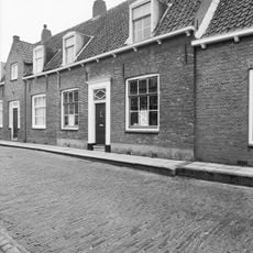
Oudestraat 41, Veere
139 m
Kapellestraat 25, Veere
80 m
Oudestraat 14, Veere
151 m
Pandje met langsgevel aan de straat
89 m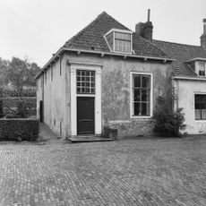
Oudestraat 51, veere
82 m
Huis met gepleisterde puntgevel
81 m
Kapellestraat 7, Veere
128 m
Vierkant gebouwtje op de grens van het kerkterrein, waarin vensters met kleine roedenverdeling
56 m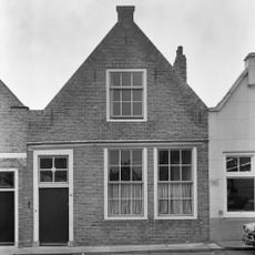
Kapellestraat 5, Veere
134 m
Huis met gepleisterde topgevel aan de straat
72 m
Kaai 87, Veere
160 m
Kapellestraat 23, Veere
78 m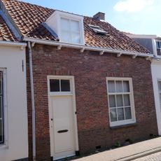
Pandje met vernieuwde langsgevel aan de straat
83 m
Pandje met langsgevel aan de straat
80 m
Arbeidershuisje met gepleisterde gevel
97 m
Klein boerenhuisje
77 m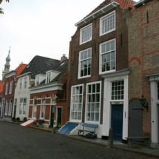
Kaai 75, Veere
160 m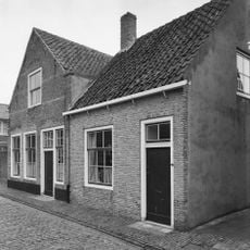
Baljuwstraat 3, Veere
76 m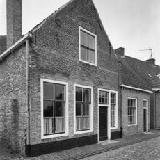
Baljuwstraat 1, Veere
74 m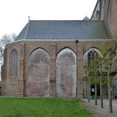
Kleine Kerk (Veere)
99 mReviews
Visited this place? Tap the stars to rate it and share your experience / photos with the community! Try now! You can cancel it anytime.
Discover hidden gems everywhere you go!
From secret cafés to breathtaking viewpoints, skip the crowded tourist spots and find places that match your style. Our app makes it easy with voice search, smart filtering, route optimization, and insider tips from travelers worldwide. Download now for the complete mobile experience.

A unique approach to discovering new places❞
— Le Figaro
All the places worth exploring❞
— France Info
A tailor-made excursion in just a few clicks❞
— 20 Minutes