Stortuva, Berggipfel in Norwegen
Location: Bindal
Elevation above the sea: 660 m
GPS coordinates: 65.23735,12.58512
Latest update: November 15, 2025 11:35
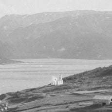
Tosen Chapel
9.6 km
Tosen
7 km
Votnmyra
2.7 km
Eidvatnet
3.1 km
Grytendalsfossen
11.7 km
Mølnfossen
5.2 km
Bunesfallan
11.2 km
Ursvatnet
6.8 km
Søbergfossen
3 km
Tolåmarkbrunen
11.6 km
Grytstiflåget
9.2 km
Rånvikknubban
11.6 km
Kustiflåget
8.8 km
Oksbåslia
6.1 km
Søbergsvatnet
3.4 km
Bautasteinslokalitet
9.3 km
Gravtinden
11.2 km
Tosen Kirkegård
9.9 km
Saus
9.8 km
Finnhytteenget
3.3 km
Flatmo
10 km
Flatmostien
9.4 km
Storstein
9.6 km
Hundflåget
8.4 km
Bunesfallan
11.2 km
Mølnfossen
5.2 km
Storfallet
3.5 km
Søbergfossen
3 kmReviews
Visited this place? Tap the stars to rate it and share your experience / photos with the community! Try now! You can cancel it anytime.
Discover hidden gems everywhere you go!
From secret cafés to breathtaking viewpoints, skip the crowded tourist spots and find places that match your style. Our app makes it easy with voice search, smart filtering, route optimization, and insider tips from travelers worldwide. Download now for the complete mobile experience.

A unique approach to discovering new places❞
— Le Figaro
All the places worth exploring❞
— France Info
A tailor-made excursion in just a few clicks❞
— 20 Minutes