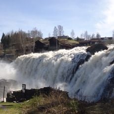
Trommefoss, Wasserfall in Norwegen
Location: Sigdal
Elevation above the sea: 365 m
GPS coordinates: 59.95580,9.64559
Latest update: October 30, 2025 06:47
Haugfossen, Simoa
14.1 km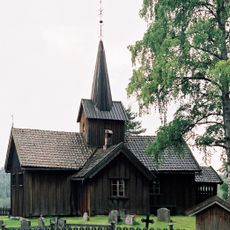
Vatnås church
1.8 km
Lyngdal church
8.2 km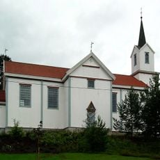
Holmen Church
10.1 km
Holmen stave church
10.5 km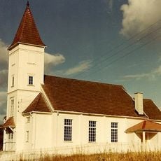
Bingen kapell
10.1 km
Holmen prestegård (Sigdal)
10.4 km
Museum at Cobalt Mine
12.4 km
The skid mines
12.4 km
Holtan vestre
12 km
Eikjebygningen (Eken), Sigdal museum
9.8 km
Langerud
12.8 km
Dønnsteinen, Låg
8.2 km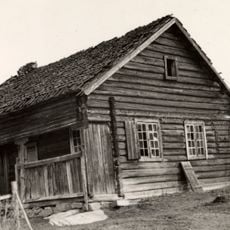
Berganstua (Øvre Bergan), Sigdal museum
9.8 km
Th. Kittelsen museet
12.5 km
1841
12.5 km
Scenic viewpoint
12.9 km
Scenic viewpoint
12.5 km
Scenic viewpoint
12.4 km
Scenic viewpoint
12 km
Scenic viewpoint
12.1 km
Scenic viewpoint
12.2 km
Scenic viewpoint
12.4 km
Scenic viewpoint
12.4 km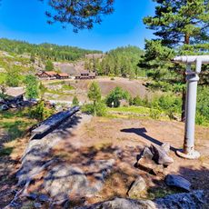
Scenic viewpoint
12.5 km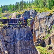
Scenic viewpoint
12.4 km
Scenic viewpoint
12.5 km
Nyfossum
13.7 kmReviews
Visited this place? Tap the stars to rate it and share your experience / photos with the community! Try now! You can cancel it anytime.
Discover hidden gems everywhere you go!
From secret cafés to breathtaking viewpoints, skip the crowded tourist spots and find places that match your style. Our app makes it easy with voice search, smart filtering, route optimization, and insider tips from travelers worldwide. Download now for the complete mobile experience.

A unique approach to discovering new places❞
— Le Figaro
All the places worth exploring❞
— France Info
A tailor-made excursion in just a few clicks❞
— 20 Minutes