
Pleasants County, County in northwestern West Virginia, United States.
Pleasants County spans 130 square miles of land along the Ohio River, featuring wooded hills and agricultural valleys in rural settings.
The Virginia General Assembly established Pleasants County on March 29, 1851, naming it after James Pleasants Jr, before joining West Virginia in 1863.
The county maintains four educational institutions, including one high school, one middle school, and two elementary schools serving local communities.
The county seat of St. Marys houses government offices at 301 Court Lane, where residents access administrative and legal services.
Middle Island near St. Marys stands as the only Ohio River island in West Virginia connected to the mainland by a bridge.
Location: West Virginia
Inception: March 29, 1851
Capital city: St. Marys
Elevation above the sea: 316 m
Shares border with: Washington County, Tyler County, Ritchie County, Wood County
Website: http://wvgenweb.org/pleasants
GPS coordinates: 39.37000,-81.16000
Latest update: April 16, 2025 03:48


Mound Cemetery
25.7 km
Marietta Earthworks
25.7 km
North Bend Rail Trail
18.9 km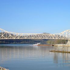
Hi Carpenter Memorial Bridge
5.1 km
North Bend State Park
17.2 km
Buckley Island
22.7 km
Williamstown Bridge
25.1 km
Willow Island Lock and Dam
13.8 km
Hune Covered Bridge
17.5 km
Bank of Cairo
18 km
Judge Joseph Barker House
14.6 km
Ritchie County Courthouse
20.1 km
Hildreth Covered Bridge
18.5 km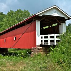
Rinard Covered Bridge
19.3 km
First Unitarian Church of Marietta
25.7 km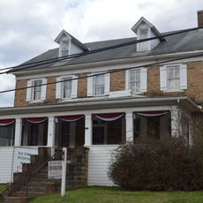
Old Stone House
18.8 km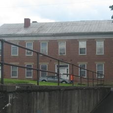
Cain House
4.8 km
Pleasants County Courthouse
4.4 km
Harrisville Historic District (Harrisville, West Virginia)
20.1 km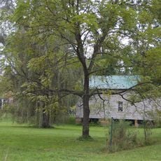
Waernicke-Hille House and Store
13.3 km
Harrisville Grade School
20.1 km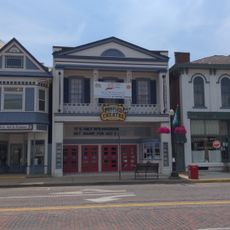
Peoples Bank Theatre
25.7 km
Mid-Ohio Valley Players Theatre
25.8 km
Muskingum Academy, 1797 - Birth of Higher Education in Ohio
25.6 km
Conus Mound
25.7 km
Erwin Hall
25.5 km
Ohio National Guard Armory
25.8 km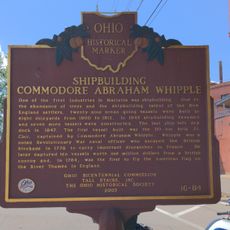
Shipbuilding, Commodore Abraham Whipple
25.5 kmReviews
Visited this place? Tap the stars to rate it and share your experience / photos with the community! Try now! You can cancel it anytime.
Discover hidden gems everywhere you go!
From secret cafés to breathtaking viewpoints, skip the crowded tourist spots and find places that match your style. Our app makes it easy with voice search, smart filtering, route optimization, and insider tips from travelers worldwide. Download now for the complete mobile experience.

A unique approach to discovering new places❞
— Le Figaro
All the places worth exploring❞
— France Info
A tailor-made excursion in just a few clicks❞
— 20 Minutes