Enable Location

We need your location to show you interesting places around you

Discover nearby places

Find interesting locations and hidden gems around you

Precise directions

Get accurate directions and distances to places

Your location is never shared with other users. It's only used when you tap the location button.

Willow Island Lock and Dam

Log in to your account

Start exploring — it's free

Trusted by 62,521 travelers worldwide

Continue with Google
Continue with Apple
or

We will send you a code to connect

By continuing, you accept our Terms and Conditions and our Privacy Policy

Check your inbox

We've sent a pincode in your inbox. Please enter the code below.

Willow Island Lock and Dam

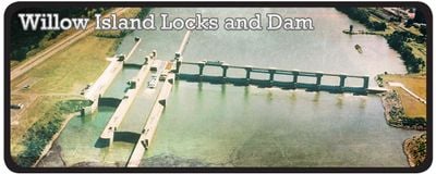
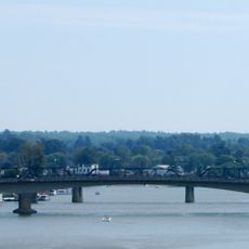
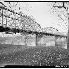
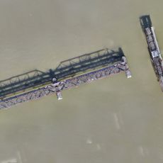
Willow Island Lock and Dam, Lock and dam complex on Ohio River near Marietta, US.

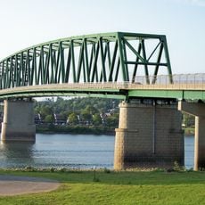
Willow Island Lock and Dam is a water control facility on the Ohio River near Marietta with two locks that help vessels navigate changing water levels. The structure also includes a dam section with gates that manage river flow and water levels for navigation and other purposes.

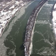
This facility was built in the late 1960s and early 1970s as part of a larger project to improve navigation on the Ohio River. The structure was completed in the mid-1970s and has since served as a key checkpoint for managing river traffic and water flow.

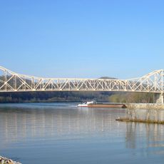
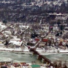
This water facility connects communities along the Ohio River and plays an important role in daily river commerce and transportation. It shapes how people use the river for moving goods and traveling between settlements.

The facility is located north of Marietta and is easily accessible by car via the main route through the area. You can walk around the site to observe the river and structures, and fishing and wildlife watching are popular activities nearby.

This facility uses large gates to control water flow through the structure, and the moving water also generates electricity for the surrounding region. This dual purpose of navigation and power generation is what sets it apart from simpler lock systems.

The community of curious travelers

AroundUs brings together thousands of curated places, local tips, and hidden gems, enriched daily by 60,000 contributors worldwide.

Start exploring
GPS coordinates
39.35930,-81.31930
Latest update
December 14, 2025 12:26
Around this place
Mound Cemetery
United States of America

Mound Cemetery

13.3 km
Marietta Earthworks
United States of America

Marietta Earthworks

13.3 km
Hi Carpenter Memorial Bridge
United States of America

Hi Carpenter Memorial Bridge

9.6 km
Fort Harmar
United States of America

Fort Harmar

13.2 km
Buckley Island
United States of America

Buckley Island

9.8 km
Williamstown Bridge
United States of America

Williamstown Bridge

12.3 km
Harmar Historic District
United States of America

Harmar Historic District

13.1 km
Washington County Courthouse
United States of America

Washington County Courthouse

13.4 km
Judge Joseph Barker House
United States of America

Judge Joseph Barker House

860 m
Hildreth Covered Bridge
United States of America

Hildreth Covered Bridge

8.4 km
Tomlinson Mansion
United States of America

Tomlinson Mansion

13.3 km
First Unitarian Church of Marietta
United States of America

First Unitarian Church of Marietta

13.1 km
Cain House
United States of America

Cain House

10 km
Pleasants County Courthouse
United States of America

Pleasants County Courthouse

10.4 km
Peoples Bank Theatre
United States of America

Peoples Bank Theatre

13.1 km
Mid-Ohio Valley Players Theatre
United States of America

Mid-Ohio Valley Players Theatre

13.2 km
Children's Toy & Doll Museum
United States of America

Children's Toy & Doll Museum

13.3 km
Putnam Street Bridge
United States of America

Putnam Street Bridge

13.4 km
Muskingum Academy, 1797 - Birth of Higher Education in Ohio
United States of America

Muskingum Academy, 1797 - Birth of Higher Education in Ohio

13 km
Erwin Hall
United States of America

Erwin Hall

13 km
Putnam Street Bridge
United States of America

Putnam Street Bridge

13.4 km
The Henry Fearing House
United States of America

The Henry Fearing House

13.3 km
Harmar Bridge
United States of America

Harmar Bridge

13.2 km
Old Muskingum Lockhouse
United States of America

Old Muskingum Lockhouse

13.2 km
Ohio National Guard Armory
United States of America

Ohio National Guard Armory

13.1 km
C. William O'Neill (1916-1978)
United States of America

C. William O'Neill (1916-1978)

13.3 km
Shipbuilding, Commodore Abraham Whipple
United States of America

Shipbuilding, Commodore Abraham Whipple

12.8 km
Lewis and Clark Expedition
United States of America

Lewis and Clark Expedition

13.2 km
Show the full map
« Willow Island Lock and Dam - Lock and dam complex on Ohio River near Marietta, US » is provided by Around Us (aroundus.com). Images and texts are derived from Wikimedia project under a Creative Commons license. You are allowed to copy, distribute, and modify copies of this page, under the conditions set by the license, as long as this note is clearly visible.

Discover hidden gems everywhere you go!

From secret cafés to breathtaking viewpoints, skip the crowded tourist spots and find places that match your style. Our app makes it easy with voice search, smart filtering, route optimization, and insider tips from travelers worldwide. Download now for the complete mobile experience.

Around Us App Screenshot

A unique approach to discovering new places

Le Figaro

All the places worth exploring

France Info

A tailor-made excursion in just a few clicks

20 Minutes

Around Us
Travel Guide & Maps
Download

Send to your phone

QR Code
1

Open the camera app on your mobile.

2

Point at the QR code with your camera. A notification will appear.

3

Tap the notification to open the link.