
Kamniti most
Location: Municipality of Brda
GPS coordinates: 46.02284,13.51386
Latest update: March 15, 2025 00:48
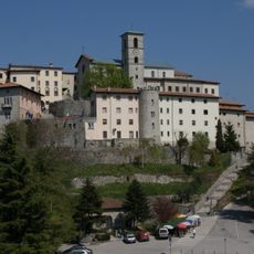
Santuario della Beata Vergine di Castelmonte
7.8 km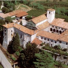
Monastery of Rosazzo
7.3 km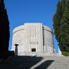
Oslavia War Memorial
9.2 km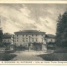
Villa Trento
8.1 km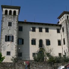
Dobrovo Castle
3 km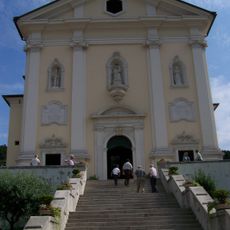
Church of Sant'Adalberto
7.6 km
San Leopoldo
7.9 km
Chiesa di San Pantaleone (Rualis, Cividale del Friuli)
9.2 km
Chiesa di San Floriano
7.3 km
Santuario Madonna d'Aiuto
6.2 km
Chiesa di Santa Maria del Rosario
6.4 km
Santissimo Nome di Maria
8.9 km
Chiesa di San Pietro
7.3 km
San Floriano
8 km
Chiesa di San Giovanni Battista
3.7 km
Chiesa dei Santi Giovanni Battista e Nicolò Vescovo
9.3 km
Chiesa dello Spirito Santo
4 km
San Giuseppe
2.8 km
Roseto dell'Abbazia di Rosazzo
7.4 km
Holy Cross Church
5.3 km
St. Mary of Help Church
4.7 km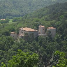
Castle of Albana
4.1 km
Saint Michael Parish Church
3.4 km
St. Jerome Church
4.4 km
Gelso nero
8.9 km
Assumption of Mary Church
4.3 km
Cerkev sv. Marije Magdalene, Krasno
3.2 km
Rocca Bernarda
6.5 kmReviews
Visited this place? Tap the stars to rate it and share your experience / photos with the community! Try now! You can cancel it anytime.
Discover hidden gems everywhere you go!
From secret cafés to breathtaking viewpoints, skip the crowded tourist spots and find places that match your style. Our app makes it easy with voice search, smart filtering, route optimization, and insider tips from travelers worldwide. Download now for the complete mobile experience.

A unique approach to discovering new places❞
— Le Figaro
All the places worth exploring❞
— France Info
A tailor-made excursion in just a few clicks❞
— 20 Minutes