Enable Location

We need your location to show you interesting places around you

Discover nearby places

Find interesting locations and hidden gems around you

Precise directions

Get accurate directions and distances to places

Your location is never shared with other users. It's only used when you tap the location button.

Jahňací štít

Log in to your account

Start exploring — it's free

Trusted by 62,034 travelers worldwide

Continue with Google
Continue with Apple
or

We will send you a code to connect

By continuing, you accept our Terms and Conditions and our Privacy Policy

Check your inbox

We've sent a pincode in your inbox. Please enter the code below.

Jahňací štít

Jahňací štít, Mountain summit in Poprad District, Slovakia

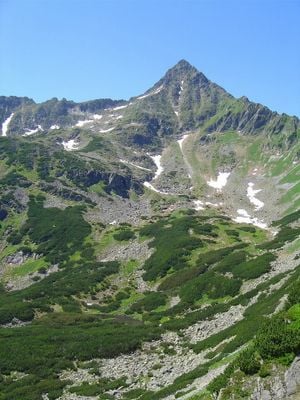
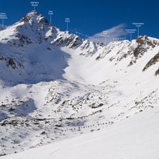
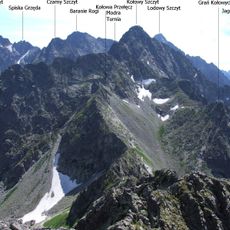
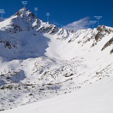
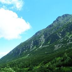
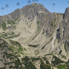
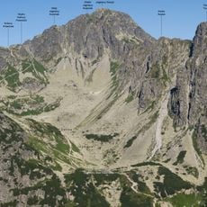
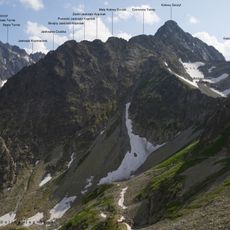
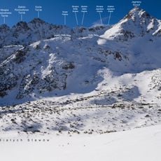
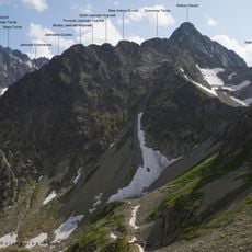
Jahňací štít is a granite peak in the High Tatras that rises to 2,229 meters (7,313 feet) with two distinct summits. A horizontal ridge connects the two tops and forms the characteristic profile of this mountain.

Robert Townson and guide Hans Gross completed the first documented tourist ascent on August 9, 1793. This climb marked the start of mountaineering activity in this high mountain region.

The name Jahňací štít means Lamb Peak, referencing mountain animals that once roamed these high elevations. Local people recognize the peak by this traditional name that connects the summit to the region's natural heritage.

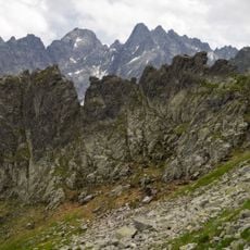
Reaching the summit requires following marked trails through Tatra National Park with proper hiking equipment. The best time to climb is between August and October when mountain conditions are most stable.

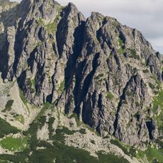
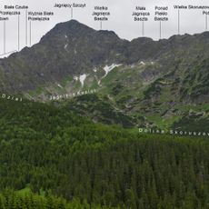
Four rocky ridges extend from this summit in different directions, each leading to separate valleys and offering distinct climbing routes. Each ridge provides different views and creates varied ways to experience this mountain landscape.

The community of curious travelers

AroundUs brings together thousands of curated places, local tips, and hidden gems, enriched daily by 60,000 contributors worldwide.

Start exploring
Location
Elevation above the sea
2,229.6 m
GPS coordinates
49.21969,20.20810
Latest update
December 10, 2025 15:50
« Jahňací štít - Mountain summit in Poprad District, Slovakia » is provided by Around Us (aroundus.com). Images and texts are derived from Wikimedia project under a Creative Commons license. You are allowed to copy, distribute, and modify copies of this page, under the conditions set by the license, as long as this note is clearly visible.

Discover hidden gems everywhere you go!

From secret cafés to breathtaking viewpoints, skip the crowded tourist spots and find places that match your style. Our app makes it easy with voice search, smart filtering, route optimization, and insider tips from travelers worldwide. Download now for the complete mobile experience.

Around Us App Screenshot

A unique approach to discovering new places

Le Figaro

All the places worth exploring

France Info

A tailor-made excursion in just a few clicks

20 Minutes

Around Us
Travel Guide & Maps
Download

Send to your phone

QR Code
1

Open the camera app on your mobile.

2

Point at the QR code with your camera. A notification will appear.

3

Tap the notification to open the link.