Enable Location

We need your location to show you interesting places around you

Discover nearby places

Find interesting locations and hidden gems around you

Precise directions

Get accurate directions and distances to places

Your location is never shared with other users. It's only used when you tap the location button.

Phatthalung

Log in to your account

Start exploring — it's free

Trusted by 61,365 travelers worldwide

Continue with Google
Continue with Apple
or

We will send you a code to connect

By continuing, you accept our Terms and Conditions and our Privacy Policy

Check your inbox

We've sent a pincode in your inbox. Please enter the code below.

Phatthalung, Province at Songkhla Lake, Thailand

Description

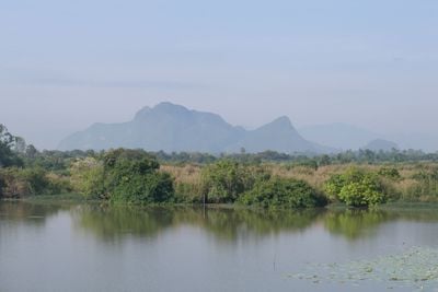
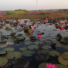
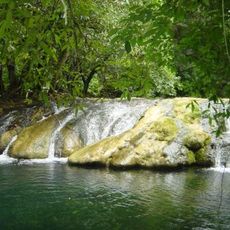
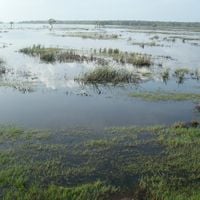
Phatthalung is an administrative division in southern Thailand that stretches along the western shore of Songkhla Lake and includes limestone mountains, wetlands, and flat plains. The boundary with the Andaman Sea lies roughly 65 kilometers to the west, while Thale Noi Waterfowl Park with its freshwater marshes and floating grass mats extends along the shoreline.

History

During the 14th century, the region existed under the Malay name Mardelong as one of twelve royal cities under Ayutthaya administration. These administrators controlled trade and local governance over several centuries.

Culture

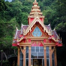
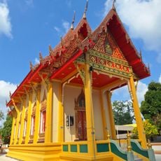
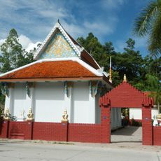
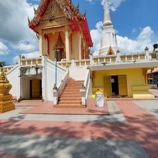
The local tradition of shadow theater Nang Talung displays carved leather figures during public performances still visible at community events today. Nora dancers perform at temple festivals wearing elaborate costumes and executing rapid footwork, accompanied by traditional percussion instruments.

Practical

The railway station sits in the main town and connects to other southern cities, while roads lead to all major neighboring towns. The nearest airport lies roughly 66 kilometers away in Trang, from where regular ground transport is available.

Did you know?

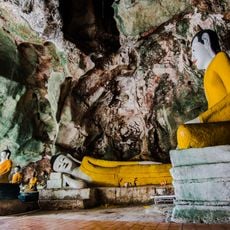
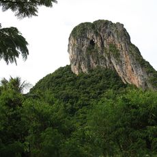
The mountain Ok Thalu possesses a natural tunnel through its limestone structure that mimics the shape of a pierced chest. The opening is clearly visible from the ground and is considered a singular geological formation in Thailand.

Location
Capital city
Phatthalung
Reference
PLG
Shares border with
Songkhla, Satun, Trang, Nakhon Si Thammarat
GPS coordinates
7.61556,100.07278
Latest update
December 13, 2025 18:41

AroundUs brings together thousands of curated places, local tips, and hidden gems, enriched daily by 60,000 contributors worldwide. Discover all places nearby (Thailand).

« Phatthalung - Province at Songkhla Lake, Thailand » is provided by Around Us (aroundus.com). Images and texts are derived from Wikimedia project under a Creative Commons license. You are allowed to copy, distribute, and modify copies of this page, under the conditions set by the license, as long as this note is clearly visible.

Discover hidden gems everywhere you go!

From secret cafés to breathtaking viewpoints, skip the crowded tourist spots and find places that match your style. Our app makes it easy with voice search, smart filtering, route optimization, and insider tips from travelers worldwide. Download now for the complete mobile experience.

Around Us App Screenshot

A unique approach to discovering new places

Le Figaro

All the places worth exploring

France Info

A tailor-made excursion in just a few clicks

20 Minutes

Around Us
Travel Guide & Maps
Download

Send to your phone

QR Code
1

Open the camera app on your mobile.

2

Point at the QR code with your camera. A notification will appear.

3

Tap the notification to open the link.