Enable Location

We need your location to show you interesting places around you

Discover nearby places

Find interesting locations and hidden gems around you

Precise directions

Get accurate directions and distances to places

Your location is never shared with other users. It's only used when you tap the location button.

Christian County

Log in to your account

Start exploring — it's free

Trusted by 62,996 travelers worldwide

Continue with Google
Continue with Apple
or

We will send you a code to connect

By continuing, you accept our Terms and Conditions and our Privacy Policy

Check your inbox

We've sent a pincode in your inbox. Please enter the code below.

Discussion Reviews 1 Photos
23.5k Popularity

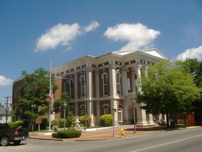
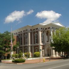
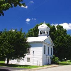
Christian County, County administration center in Hopkinsville, Kentucky, US

Christian County is an administrative area in southwestern Kentucky with Hopkinsville as its main city. The region contains farmland, residential neighborhoods, and smaller towns spread throughout the territory.

The county was established in 1796 and named after Colonel William Christian, an early settler who died in 1786 during conflicts in the frontier. This founding period reflects Kentucky's development during American westward expansion.

The Hometown Hero Banners program in Hopkinsville displays photographs of local veterans on lamp posts throughout the downtown area. This visible tribute reflects how the community honors those who served in the military.

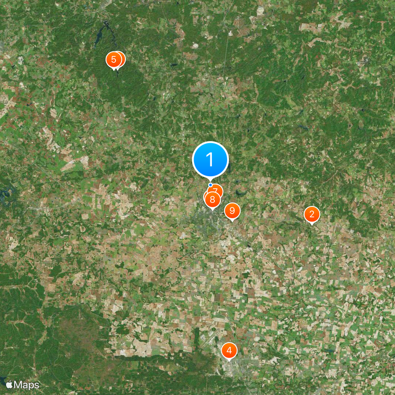
The county center is easily accessible by car along main highways that run through the region. Visitors should plan to travel by vehicle since public transportation options are limited outside the main city.

The northwestern section of the county experienced the longest duration of a solar eclipse during an astronomical event in 2017. This rare occurrence made the area a special viewing location for sky watchers.

The community of curious travelers

AroundUs brings together thousands of curated places, local tips, and hidden gems, enriched daily by 60,000 contributors worldwide.

Start exploring
Location
Inception
December 13, 1796
Capital city
Hopkinsville
Shares border with
Hopkins County, Muhlenberg County, Todd County, Montgomery County, Stewart County, Trigg County, Caldwell County
GPS coordinates
36.90000,-87.49000
Latest update
December 20, 2025 14:08
Around this place
Jefferson Davis State Historic Site
United States of America

Jefferson Davis State Historic Site

18.1 km
United States of America

Pennyrile Forest State Resort Park

24.7 km
United States of America

Don F. Pratt Memorial Museum

29.3 km
United States of America

Pennyrile State Forest

25 km
Confederate Memorial Fountain in Hopkinsville
United States of America

Confederate Memorial Fountain in Hopkinsville

3.7 km
Latham Confederate Monument
United States of America

Latham Confederate Monument

2.9 km
Hopkinsville Commercial Historic District
United States of America

Hopkinsville Commercial Historic District

4.1 km
United States of America

Boatright House

7 km
United States of America

Church Hill Grange Hall

13.5 km
United States of America

Maplewood

22.3 km
J. B. Knight House
United States of America

J. B. Knight House

4.6 km
East 7th Street Historic District
United States of America

East 7th Street Historic District

4.1 km
United States of America

Glen Burnie

25.7 km
United States of America

Thomas Dawson House

26.5 km
E.H. Higgins House
United States of America

E.H. Higgins House

4.3 km
Lafayette Methodist Church
United States of America

Lafayette Methodist Church

30.7 km
Cranor School
United States of America

Cranor School

26.9 km
Jefferson Davis Monument
United States of America

Jefferson Davis Monument

18.1 km
United States of America

Lake Morris

4.5 km
United States of America

Lake Boxley

5.5 km
United States of America

Lake Tandy

4.8 km
United States of America

Princess Theatre

3.8 km
United States of America

Kentucky Theatre

3.8 km
United States of America

Hopkinsville Drive In Theater

3.8 km
United States of America

Lake Blythe

2.8 km
United States of America

Taylor Bluff

24.5 km
United States of America

Cedar Bluff

11.6 km
United States of America

Copeland Bluff

30.3 km
Show the full map
Reviews
Share your experience

No review yet

Discussions
Start a discussion...

No discussion yet

« Christian County - County administration center in Hopkinsville, Kentucky, US » is provided by Around Us (aroundus.com). Images and texts are derived from Wikimedia project under a Creative Commons license. You are allowed to copy, distribute, and modify copies of this page, under the conditions set by the license, as long as this note is clearly visible.

Discover hidden gems everywhere you go!

From secret cafés to breathtaking viewpoints, skip the crowded tourist spots and find places that match your style. Our app makes it easy with voice search, smart filtering, route optimization, and insider tips from travelers worldwide. Download now for the complete mobile experience.

Around Us App Screenshot

A unique approach to discovering new places

Le Figaro

All the places worth exploring

France Info

A tailor-made excursion in just a few clicks

20 Minutes

Around Us
Travel Guide & Maps
Download

Send to your phone

QR Code
1

Open the camera app on your mobile.

2

Point at the QR code with your camera. A notification will appear.

3

Tap the notification to open the link.