Enable Location

We need your location to show you interesting places around you

Discover nearby places

Find interesting locations and hidden gems around you

Precise directions

Get accurate directions and distances to places

Your location is never shared with other users. It's only used when you tap the location button.

Jefferson City

Log in to your account

Start exploring — it's free

Trusted by 61,344 travelers worldwide

Continue with Google
Continue with Apple
or

We will send you a code to connect

By continuing, you accept our Terms and Conditions and our Privacy Policy

Check your inbox

We've sent a pincode in your inbox. Please enter the code below.

Jefferson City, State capital on the Missouri River, United States

Description

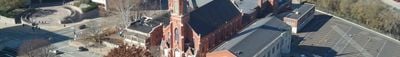
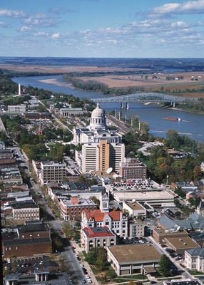
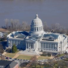
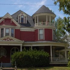
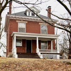
Jefferson City sits on both banks of the Missouri River and spreads across gentle hills where residential neighborhoods and government buildings mix together. The Capitol dome rises above the river valley and marks the political center of Missouri, while streets lined with older brick houses and newer administrative structures alternate behind it.

History

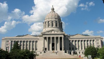
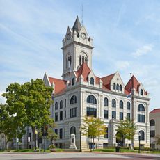
The site was chosen in 1821 as capital of the newly formed state of Missouri after Congress required it to be near the mouth of the Osage River. The current Capitol building rose after a fire in 1911 and was constructed between 1913 and 1917.

Culture

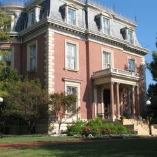
The city takes its name from Thomas Jefferson, the third President of the United States and author of the Declaration of Independence. This historical connection appears in many public buildings and street names that visitors discover while walking through the government district.

Practical

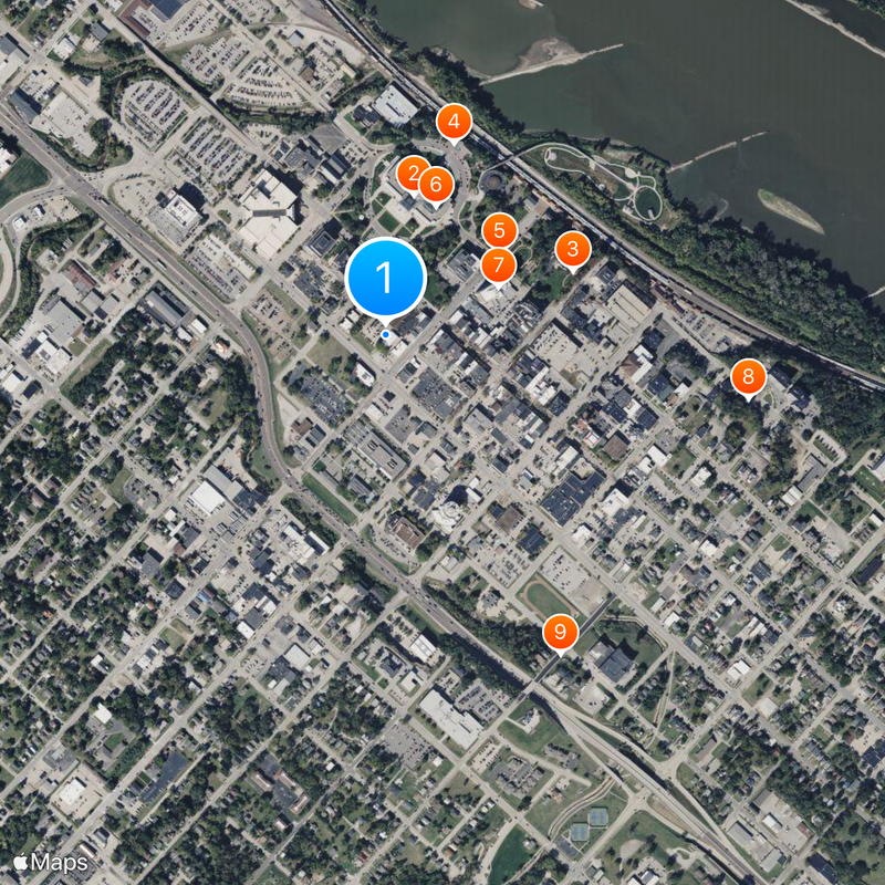
The city is easy to explore on foot, especially around the Capitol and the nearby riverfront where paths run along the waterfront promenade. Visitors can orient themselves using information panels that mark the main public buildings and historical sites.

Did you know?

The river divides the city into two unequal halves, with the smaller northern section sitting on a peninsula nearly surrounded by water. This geographical feature makes crossing the bridges part of daily life for many residents and commuters.

Location
Location
Inception
1821
Elevation above the sea
192 m
GPS coordinates
38.57667,-92.17361
Latest update
December 12, 2025 20:48

AroundUs brings together thousands of curated places, local tips, and hidden gems, enriched daily by 60,000 contributors worldwide. Discover all places nearby (Cole County).

Around this place
Missouri State Capitol
United States of America

Missouri State Capitol

276 m
Missouri Governor's Mansion
United States of America

Missouri Governor's Mansion

383 m
United States of America

Fountain of the Centaurs

394 m
Jefferson Landing State Historic Site
United States of America

Jefferson Landing State Historic Site

271 m
United States of America

Missouri State Museum

267 m
Missouri State Capitol Historic District
United States of America

Missouri State Capitol Historic District

237 m
Jefferson Female Seminary
United States of America

Jefferson Female Seminary

712 m
Hobo Hill Historic District
United States of America

Hobo Hill Historic District

705 m
Hugh and Bessie Stephens House
United States of America

Hugh and Bessie Stephens House

826 m
Philip Hess House
United States of America

Philip Hess House

629 m
Ivy Terrace
United States of America

Ivy Terrace

744 m
Lohman's Landing Building
United States of America

Lohman's Landing Building

282 m
Cole County Courthouse and Jail-Sheriff's House
United States of America

Cole County Courthouse and Jail-Sheriff's House

429 m
William E. and Frederica M. Zuendt House
United States of America

William E. and Frederica M. Zuendt House

855 m
Henry and Elizabeth Bockrath House
United States of America

Henry and Elizabeth Bockrath House

632 m
Cole County Historical Society Building
United States of America

Cole County Historical Society Building

392 m
Tergin Apartment Building
United States of America

Tergin Apartment Building

148 m
Munichburg Commercial Historic District
United States of America

Munichburg Commercial Historic District

687 m
Broadway-Dunklin Historic District
United States of America

Broadway-Dunklin Historic District

495 m
Albert and Wilhelmina Thomas House
United States of America

Albert and Wilhelmina Thomas House

374 m
Claud D. Grove and Berenice Sinclair Grove House
United States of America

Claud D. Grove and Berenice Sinclair Grove House

836 m
United States of America

Dunklin Theatre

517 m
United States of America

Capitol City Cinema

175 m
United States of America

Missouri Governor's Mansion Tours

374 m
United States of America

Scene One Theatre

169 m

Elizabeth Rozier Gallery

389 m
United States of America

Work of art, statue

206 m
United States of America

Statue, Work of art

244 m
Show the full map
« Jefferson City - State capital on the Missouri River, United States » is provided by Around Us (aroundus.com). Images and texts are derived from Wikimedia project under a Creative Commons license. You are allowed to copy, distribute, and modify copies of this page, under the conditions set by the license, as long as this note is clearly visible.

Discover hidden gems everywhere you go!

From secret cafés to breathtaking viewpoints, skip the crowded tourist spots and find places that match your style. Our app makes it easy with voice search, smart filtering, route optimization, and insider tips from travelers worldwide. Download now for the complete mobile experience.

Around Us App Screenshot

A unique approach to discovering new places

Le Figaro

All the places worth exploring

France Info

A tailor-made excursion in just a few clicks

20 Minutes

Around Us
Travel Guide & Maps
Download

Send to your phone

QR Code
1

Open the camera app on your mobile.

2

Point at the QR code with your camera. A notification will appear.

3

Tap the notification to open the link.