Jefferson County

Log in to your account

AroundUs is a community-driven map of interesting places, built by curious explorers like you. It grows with every review, story, and photo you share.
Connect to save your favorite spots, contribute locations, and create personalized routes.
Continue with Google
Continue with Apple
Continue with X
Continue with Facebook
Continue with email
By continuing, you accept our Terms and Conditions and our Privacy Policy
Create an account
Add to collection
Map
Suggest a change
Share

Jefferson County, Administrative division in southeastern Wisconsin, US

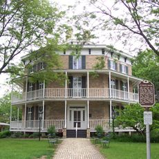
Jefferson County is an administrative division in southeastern Wisconsin located between Madison and Milwaukee. The area contains rivers, forests, and farmland with multiple towns and villages spread throughout the region.

The county was established in 1836 when the Wisconsin Territory organized and created local government structures for this region. This early founding helped shape the development of southeastern Wisconsin as settlements grew and expanded.

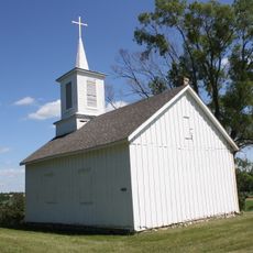
The county shows a strong connection to farming and rural traditions that shape how communities are organized and function today. You can see this in how the landscape is used, with family farms and agricultural practices still defining the character of the towns and villages.

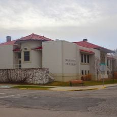
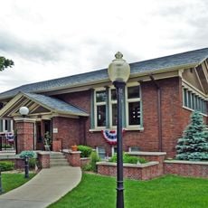
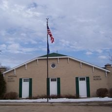
Administrative services and public records are handled at the county courthouse located in the city of Jefferson. Visitors and residents can access government services and documents they need at this central location.

Towns in this county have direct control over zoning decisions, unlike many other Wisconsin counties where this authority is held by the county government. This local autonomy allows communities to shape their own development and land use patterns.

Location: Wisconsin

Inception: 1836

Capital city: Jefferson

Shares border with: Dodge County, Waukesha County, Walworth County, Rock County, Dane County

Website: https://jeffersoncountywi.gov

GPS coordinates: 43.02000,-88.78000

Latest update: December 7, 2025 10:07

Photos
Around this place
Aztalan State Park
United States of America

Aztalan State Park

8.4 km
First Kindergarten
United States of America

First Kindergarten

19.3 km
Octagon House
United States of America

Octagon House

19.3 km
Richard C. Smith House
United States of America

Richard C. Smith House

2.7 km
Panther Intaglio Effigy Mound
United States of America

Panther Intaglio Effigy Mound

12.2 km
Fireside Dinner Theatre
United States of America

Fireside Dinner Theatre

13 km
Lorine Niedecker Cottage
United States of America

Lorine Niedecker Cottage

16.5 km
Arthur R. Hoard House
United States of America

Arthur R. Hoard House

11.6 km
L. D. Fargo Public Library
United States of America

L. D. Fargo Public Library

12.6 km
Dwight Foster Public Library
United States of America

Dwight Foster Public Library

11.4 km
David W. and Jane Curtis House
United States of America

David W. and Jane Curtis House

10.9 km
Fort Atkinson Water Tower
United States of America

Fort Atkinson Water Tower

11.3 km
St. Wenceslaus Roman Catholic Church
United States of America

St. Wenceslaus Roman Catholic Church

19.5 km
Merchants Avenue Historic District
United States of America

Merchants Avenue Historic District

11.6 km
St. Paul's Episcopal Church
United States of America

St. Paul's Episcopal Church

19.6 km
August and Eliza Fuermann Jr. House
United States of America

August and Eliza Fuermann Jr. House

19.6 km
North Washington Street Historic District
United States of America

North Washington Street Historic District

20.2 km
City of Waterloo Carousel
United States of America

City of Waterloo Carousel

24.4 km
Jefferson Public Library
United States of America

Jefferson Public Library

2.9 km
Hebron Town Hall
United States of America

Hebron Town Hall

12.9 km
Monroe McKenzie House
United States of America

Monroe McKenzie House

22.4 km
Albert and Mary Shekey House
United States of America

Albert and Mary Shekey House

19 km
Palmyra Boy Scout Cabin
United States of America

Palmyra Boy Scout Cabin

22.4 km
South Washington Street Historic District
United States of America

South Washington Street Historic District

19.6 km
Hoard Historical Museum
United States of America

Hoard Historical Museum

11.6 km
Main Street Historic District
United States of America

Main Street Historic District

11.3 km
Spring Lake 38
United States of America

Spring Lake 38

22.9 km
Watertown Public Library
United States of America

Watertown Public Library

19.9 km
Show the full map
Reviews

Visited this place? Tap the stars to rate it and share your experience / photos with the community! Try now! You can cancel it anytime.

Administrative divisions
« Jefferson County - Administrative division in southeastern Wisconsin, US » is provided by Around Us (aroundus.com). Images and texts are derived from Wikimedia project under a Creative Commons license. You are allowed to copy, distribute, and modify copies of this page, under the conditions set by the license, as long as this note is clearly visible.

Discover hidden gems everywhere you go!

From secret cafés to breathtaking viewpoints, skip the crowded tourist spots and find places that match your style. Our app makes it easy with voice search, smart filtering, route optimization, and insider tips from travelers worldwide. Download now for the complete mobile experience.

Around Us App Screenshot

A unique approach to discovering new places

Le Figaro

All the places worth exploring

France Info

A tailor-made excursion in just a few clicks

20 Minutes