Enable Location

We need your location to show you interesting places around you

Discover nearby places

Find interesting locations and hidden gems around you

Precise directions

Get accurate directions and distances to places

Your location is never shared with other users. It's only used when you tap the location button.

Siler City

Log in to your account

Start exploring — it's free

Trusted by 62,043 travelers worldwide

Continue with Google
Continue with Apple
or

We will send you a code to connect

By continuing, you accept our Terms and Conditions and our Privacy Policy

Check your inbox

We've sent a pincode in your inbox. Please enter the code below.

Siler City, Rural commercial center in Chatham County, United States

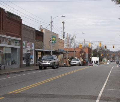
Siler City is a municipality in western Chatham County, North Carolina that spans several square miles in a rural setting. The town is shaped by Loves Creek and functions as a regional center for commerce and small business.

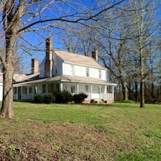
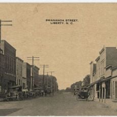
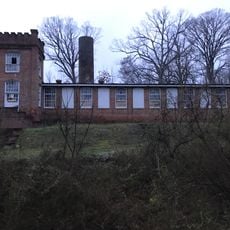
The settlement was founded when Plikard Dederic Siler and Elizabeth Hartsoe Siler established their homestead near Lacy's Creek, several miles from where the town center stands today. The place evolved from a farming community to an industrial center focused on poultry processing.

The town is home to a diverse population, with many residents of Latin American origin who shape the social and economic life here. Their presence is visible through local businesses, traditions, and the way the community comes together.

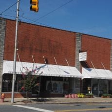
The town is best explored on foot, with most essential facilities and businesses located within or near the downtown area. A small airport located southwest of the center offers flight options for those traveling from elsewhere.

The rapid transformation from a farming trade center to a poultry processing hub starting in the 1990s brought large waves of immigration from Latin America. This shift happened faster than in most similar towns in the region, reshaping the entire character of the place.

The community of curious travelers

AroundUs brings together thousands of curated places, local tips, and hidden gems, enriched daily by 60,000 contributors worldwide.

Start exploring
Location
Elevation above the sea
190 m
GPS coordinates
35.72610,-79.46310
Latest update
December 17, 2025 09:58
Around this place
United States of America

Alston-DeGraffenried Plantation

19.9 km
United States of America

Former High Point Bending and Chair Company

345 m
United States of America

Aspen Hall

17.2 km
United States of America

DeGraffenreidt-Johnson House

15.4 km
United States of America

William Teague House

5.5 km
Marley House
United States of America

Marley House

8.2 km
United States of America

Mount Vernon Springs Historic District

7.7 km
United States of America

Hadley House and Grist Mill

14.8 km
Liberty Historic District
United States of America

Liberty Historic District

17.6 km
United States of America

Cadmus N. Bray House

306 m
United States of America

Bray-Paschal House

5.3 km
United States of America

William Alston Rives House

18.2 km
United States of America

Gregson-Hadley House

396 m
Coleridge Historic District
United States of America

Coleridge Historic District

16.9 km
United States of America

Bowen-Jordan Farm

6.5 km
Siler City Commercial Historic District
United States of America

Siler City Commercial Historic District

342 m
United States of America

Siler City High School

436 m
United States of America

Hotel Hadley

315 m
United States of America

Whitehead-Fogleman Farm

12 km
United States of America

Siler City City Hall

147 m
United States of America

Burdett Woody House

16.2 km
United States of America

North Third Avenue Historic District

0 m
United States of America

Paschal-Womble House

19 km
United States of America

East Raleigh Street Historic District

399 m
United States of America

Goldston Commercial Historic District

19.2 km
United States of America

Snipes-Fox House

865 m
United States of America

Siler City Water Supply Lake Number One

8.9 km
United States of America

Siler City Country Club

2.6 km
Show the full map
« Siler City - Rural commercial center in Chatham County, United States » is provided by Around Us (aroundus.com). Images and texts are derived from Wikimedia project under a Creative Commons license. You are allowed to copy, distribute, and modify copies of this page, under the conditions set by the license, as long as this note is clearly visible.

Discover hidden gems everywhere you go!

From secret cafés to breathtaking viewpoints, skip the crowded tourist spots and find places that match your style. Our app makes it easy with voice search, smart filtering, route optimization, and insider tips from travelers worldwide. Download now for the complete mobile experience.

Around Us App Screenshot

A unique approach to discovering new places

Le Figaro

All the places worth exploring

France Info

A tailor-made excursion in just a few clicks

20 Minutes

Around Us
Travel Guide & Maps
Download

Send to your phone

QR Code
1

Open the camera app on your mobile.

2

Point at the QR code with your camera. A notification will appear.

3

Tap the notification to open the link.