Fishers

Log in to your account

AroundUs is a community-driven map of interesting places, built by curious explorers like you. It grows with every review, story, and photo you share.
Connect to save your favorite spots, contribute locations, and create personalized routes.
By continuing, you accept our Terms and Conditions and our Privacy Policy
Add to collection
Map
Suggest a change
Share

Fishers, Suburban city in Hamilton County, Indiana

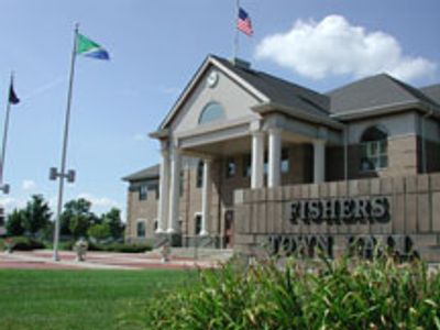
Fishers is a city in Hamilton County, Indiana, positioned northeast of Indianapolis and covering parts of Fall Creek and Delaware townships. The area includes housing subdivisions, office parks, retail centers, and open green spaces linked by a network of paved trails.

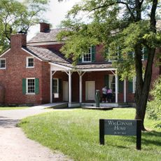
A settlement formed in the early 1870s after Salathial Fisher donated land for a railway stop along the Peru & Indianapolis line. The community remained small for decades before suburban expansion began in the late 20th century, driven by proximity to the capital.

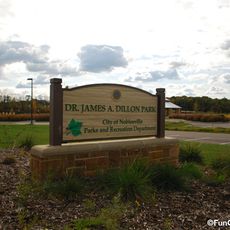
Residents use the trail network year-round, walking or cycling through neighborhoods that blend older farmland patterns with newer suburban layouts. Local gatherings often take place in parks or community centers, reflecting the area's family-oriented character.

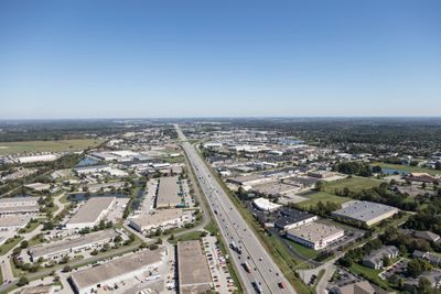
Two major highways run through the area, making it easy to drive in from nearby cities or explore surrounding neighborhoods by car. Visitors often use the paved trail system to move between parks and commercial zones without navigating traffic.

The community grew faster than almost any other in Indiana during the final decades of the 20th century, multiplying its population by more than 250 times in about sixty years. Today it holds more residents than many older county seats in the state, despite barely appearing on maps until recent decades.

Location: Hamilton County

Location: Indianapolis metropolitan area

Inception: 1872

Elevation above the sea: 249 m

Shares border with: Indianapolis

Website: http://fishers.in.us

GPS coordinates: 39.95611,-86.01278

Latest update: December 5, 2025 16:31

Around this place
Show the full map
Fort Benjamin Harrison
United States of America

Fort Benjamin Harrison

10.3 km
Ruoff Music Center
United States of America

Ruoff Music Center

8.9 km
Conner Prairie
United States of America

Conner Prairie

3.4 km
Geist Reservoir
United States of America

Geist Reservoir

5.5 km
Fort Harrison State Park
United States of America

Fort Harrison State Park

9.9 km
The Palladium at the Center for Performing Arts
United States of America

The Palladium at the Center for Performing Arts

10.1 km
Skiles Test Nature Park
United States of America

Skiles Test Nature Park

10.2 km
Carmel Clay Public Library
United States of America

Carmel Clay Public Library

9.7 km
West-Harris House
United States of America

West-Harris House

4.8 km
Hillcrest Country Club
United States of America

Hillcrest Country Club

10.1 km
Camp Edwin F. Glenn
United States of America

Camp Edwin F. Glenn

10.8 km
Oaklandon Historic District
United States of America

Oaklandon Historic District

10.2 km
Hamilton County Courthouse
United States of America

Hamilton County Courthouse

10 km
Christopher Apple House
United States of America

Christopher Apple House

10.6 km
Marion County Bridge 0501F
United States of America

Marion County Bridge 0501F

9.3 km
John Kinzer House
United States of America

John Kinzer House

8.6 km
Dr. Samuel Harrell House
United States of America

Dr. Samuel Harrell House

10.3 km
Noblesville Milling Company Mill
United States of America

Noblesville Milling Company Mill

9.5 km
Christus
United States of America

Christus

5.1 km
William Houston Craig House
United States of America

William Houston Craig House

10 km
Conner Street Historic District
United States of America

Conner Street Historic District

10 km
Noblesville Commercial Historic District
United States of America

Noblesville Commercial Historic District

10 km
Daniel Craycraft House
United States of America

Daniel Craycraft House

9.9 km
Cole-Evans House
United States of America

Cole-Evans House

10.6 km
Judge Earl S. Stone House
United States of America

Judge Earl S. Stone House

9.8 km
Robert L. Wilson House
United States of America

Robert L. Wilson House

9.9 km
Catherine Street Historic District
United States of America

Catherine Street Historic District

10.3 km
South 9th Street Historic District
United States of America

South 9th Street Historic District

9.7 km
Show the full map

Reviews

Visited this place? Tap the stars to rate it and share your experience / photos with the community! Try now! You can cancel it anytime.

« Fishers - Suburban city in Hamilton County, Indiana » is provided by Around Us (aroundus.com). Images and texts are derived from Wikimedia project under a Creative Commons license. You are allowed to copy, distribute, and modify copies of this page, under the conditions set by the license, as long as this note is clearly visible.

Discover hidden gems everywhere you go!

From secret cafés to breathtaking viewpoints, skip the crowded tourist spots and find places that match your style. Our app makes it easy with voice search, smart filtering, route optimization, and insider tips from travelers worldwide. Download now for the complete mobile experience.

Around Us App Screenshot

A unique approach to discovering new places

Le Figaro

All the places worth exploring

France Info

A tailor-made excursion in just a few clicks

20 Minutes