Chest opened
+${chestReward.xp} XP
Explorer
NOUVEAU ×${chestReward.collectible.quantity}
tapez pour fermer
Chest locked

Open chests in the app

Around Us is built for your phone — chests unlock when you walk, explore and capture nearby places.

Enable Location

We need your location to show you interesting places around you

Discover nearby places

Find interesting locations and hidden gems around you

Precise directions

Get accurate directions and distances to places

Your location is never shared with other users. It's only used when you tap the location button.

Chicago Lawn

Log in to your account

Start exploring — it's free

Trusted by 72,891 travelers worldwide

Continue with Google
Continue with Apple
or

We will send you a code to connect

By continuing, you accept our Terms and Conditions and our Privacy Policy

Check your inbox

We've sent a pincode in your inbox. Please enter the code below.

Discussion Reviews 1 Photos
500+ Popularity

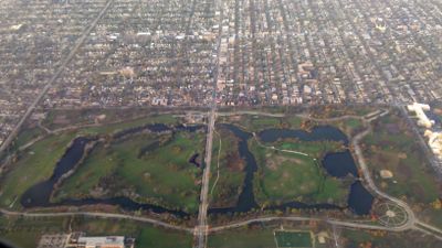
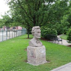
Chicago Lawn, Residential community area in Southwest Side of Chicago, US

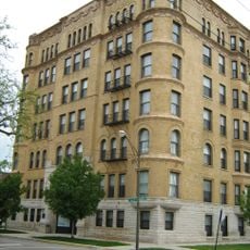
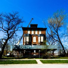
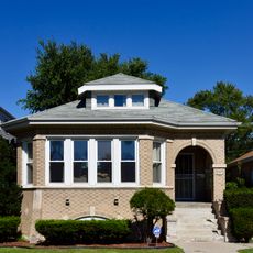
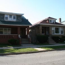
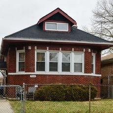
Chicago Lawn is a residential community on the southwest side of Chicago featuring tree-lined streets with single-family homes and multi-story apartment buildings. The neighborhood centers around Central Park Avenue and 59th Street with a mix of architectural styles from different periods.

The area experienced rapid growth between the 1920s and 1930s as its population expanded from about 14,000 to around 47,000 residents. This expansion was driven by German, Irish, Polish, and Lithuanian immigrants who established homes and community institutions.

The neighborhood serves as a gathering place for African American, Hispanic, and Middle Eastern communities, with their presence visible in local food, shops, and religious institutions. This mix of traditions shapes how people move through and use the streets daily.

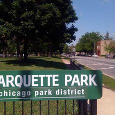
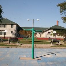
The neighborhood is accessible by multiple public transportation routes connecting to downtown Chicago, making it easy to reach from other areas. Schools, parks, and community centers are spread throughout, offering visitors places to stop and rest or engage with local facilities.

A major bakery facility owned by the National Biscuit Company once operated here, becoming an important employer in the area during its peak years. The factory doubled its production capacity in the late 1990s, significantly shaping the neighborhood's economic activity.

The community of curious travelers

AroundUs brings together thousands of curated places, local tips, and hidden gems, enriched daily by 60,000 contributors worldwide.

Start exploring
Location
Shares border with
Gage Park
GPS coordinates
41.77000,-87.69000
Latest update
December 14, 2025 20:25
Around this place
Goldblatt's Building
United States of America

Goldblatt's Building

4.7 km
Marquette Park
United States of America

Marquette Park

1.1 km
William and Jessie M. Adams House
United States of America

William and Jessie M. Adams House

5.4 km
Sherman Park
United States of America

Sherman Park

4.2 km
Yale Apartments
United States of America

Yale Apartments

4.9 km
Raber House
United States of America

Raber House

5.7 km
Cornell Square
United States of America

Cornell Square

3.9 km
Brainerd Bungalow Historic District
United States of America

Brainerd Bungalow Historic District

5.6 km
West Chatham Bungalow Historic District
United States of America

West Chatham Bungalow Historic District

5.5 km
Auburn Gresham Bungalow Historic District
United States of America

Auburn Gresham Bungalow Historic District

2.4 km
St. Martin de Tours Church
United States of America

St. Martin de Tours Church

5.1 km
Apostolic House of Prayer
United States of America

Apostolic House of Prayer

4.1 km
Abraham Lincoln
United States of America

Abraham Lincoln

2.1 km
United States of America

Englewood Junction

4.3 km
United States of America

Renaissance Park Sculpture

3.5 km
United States of America

Flight Forms

4.5 km
Paul Cornell
United States of America

Paul Cornell

4 km
United States of America

Thurgood Marshall

3.3 km
United States of America

Giant Cow

4.3 km
United States of America

Eye Can See Now

2.9 km
United States of America

Statue, Work of art

154 m
United States of America

Work of art, sculpture

5.4 km
United States of America

Work of art, sculpture

5.3 km
United States of America

Work of art, sculpture

4.2 km
United States of America

Mural, Work of art

4.3 km
United States of America

Mural, Work of art

4.3 km
United States of America

Sherman American History Series

4.2 km
United States of America

Space Junction of Energy

4.4 km
Show the full map
Reviews
Share your experience

No review yet

Discussions
Start a discussion...

No discussion yet

« Chicago Lawn - Residential community area in Southwest Side of Chicago, US » is provided by Around Us (aroundus.com). Images and texts are derived from Wikimedia project under a Creative Commons license. You are allowed to copy, distribute, and modify copies of this page, under the conditions set by the license, as long as this note is clearly visible.

Discover hidden gems everywhere you go!

From secret cafés to breathtaking viewpoints, skip the crowded tourist spots and find places that match your style. Our app makes it easy with voice search, smart filtering, route optimization, and insider tips from travelers worldwide. Download now for the complete mobile experience.

Around Us App Screenshot

A unique approach to discovering new places

Le Figaro

All the places worth exploring

France Info

A tailor-made excursion in just a few clicks

20 Minutes

Around Us
Travel Guide & Maps
Download

Send to your phone

QR Code
1

Open the camera app on your mobile.

2

Point at the QR code with your camera. A notification will appear.

3

Tap the notification to open the link.