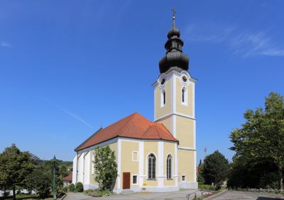
Prambachkirchen, municipality in Eferding District, Upper Austria, Austria
Location: Eferding District
Elevation above the sea: 374 m
Shares border with: Waizenkirchen, Stroheim, Hinzenbach, Sankt Marienkirchen an der Polsenz, Sankt Thomas, Michaelnbach
Email: gemeinde@prambachkirchen.ooe.gv.at
Website: http://prambachkirchen.at
GPS coordinates: 48.31667,13.90000
Latest update: April 1, 2025 02:01
Schaunberg Castle Ruins
6.4 km
Schloss Dachsberg
2.8 km
Schloss Weidenholz
3.9 km
Schloss Hochscharten
3.3 km
Naturpark Obst-Hügel-Land
5.9 km
Parish church in Sankt Marienkirchen an der Polsenz
6.3 km
Gut Waikhartsberg
3.1 km
Sankt Peter und Paul
3.5 km
Saint Margaret church
366 m
Pfarrkirche St. Thomas bei Waizenkirchen
3.8 km
Malteserstöckl, Stroheim
4.9 km
Sankt Johannes der Täufer
4.9 km
Garten der Geheimnisse
6 km
Heimathaus Sankt Marienkirchen an der Polsenz
6.4 km
Landerl-Kapelle
6.5 km
Spitalskapelle hl. Nikolaus
3.7 km
Samareiner Freibad
6.1 km
Bauernhof (Anlage), Moarhof
3 km
Marktbrunnen
3.5 km
Illigut - Kaltenbach
5.3 km
Gasthaus Zum Weißen Lamm
3.5 km
Dreifaltigkeitssäule
345 m
Alte Volksschule
3.5 km
Burg oder Schlosslinde in Schaunberg
6.4 km
Pfarrhof
6.3 km
Mayerhofer Bergwarte
6.1 km
Kriegerdenkmal
3.5 km
Linde in Waizenkirchen
4.1 kmReviews
Visited this place? Tap the stars to rate it and share your experience / photos with the community! Try now! You can cancel it anytime.
Discover hidden gems everywhere you go!
From secret cafés to breathtaking viewpoints, skip the crowded tourist spots and find places that match your style. Our app makes it easy with voice search, smart filtering, route optimization, and insider tips from travelers worldwide. Download now for the complete mobile experience.
A unique approach to discovering new places❞
— Le Figaro
All the places worth exploring❞
— France Info
A tailor-made excursion in just a few clicks❞
— 20 Minutes