Fuente Obejuna, Municipality in northern Córdoba Province, Spain
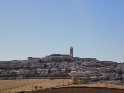
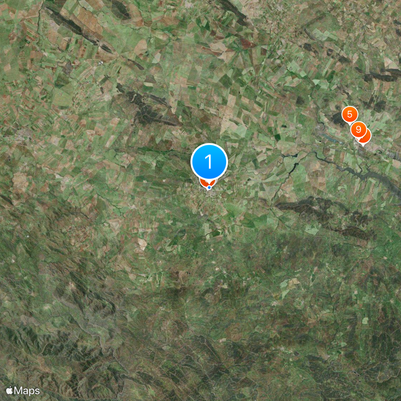
Fuente Obejuna is a municipality in Córdoba Province situated in hilly terrain typical of southern Spain's interior landscape. The settlement spreads across rural lands dotted with traditional villages and farmland.
In 1476 residents united against feudal oppression under Fernando Gómez de Guzmán, Commander of the Order of Calatrava, in an act of collective rebellion. This uprising shaped the town's place in regional history and consciousness.
The name originates from Latin meaning 'sheep fountain source' and reflects the medieval importance of water and livestock to the settlement. This naming heritage remains woven into the identity of the place today.
The town is accessible via main provincial roads through the Córdoba region and offers typical rural infrastructure. Visitors should expect straightforward local services and transport options suited to a small municipality.
Excavations nearby reveal Roman-era connections through the ancient settlement known as Fons Mellaria, suggesting honey production was historically central to the region. These archaeological findings link the modern town to layers of settlement spanning many centuries.
Location: Córdoba Province
Capital city: Fuente Obejuna
Elevation above the sea: 625 m
Part of: districte notarial de Peñarroya-Pueblonuevo, Mancomunitat de Municipis del Valle del Guadiato, Valle del Guadiato
Shares border with: Belmez, Villanueva del Rey, Espiel, Hornachuelos, Azuaga, Granja de Torrehermosa, Peraleda del Zaucejo, Los Blázquez, La Granjuela, Peñarroya-Pueblonuevo
Website: https://fuenteobejuna.es
GPS coordinates: 38.26708,-5.41965
Latest update: December 6, 2025 22:09
Castillo
18.1 km
Iglesia de San Juan Bautista
35.2 km
Bembézar Reservoir
33.9 km
Iglesia de Nuestra Señora de la Consolación
22.5 km
Church of Nuestra Señora del Castillo (Fuente Obejuna)
61 m
Escuela Politécnica Superior de Belmez
18.8 km
Casa Cardona
124 m
Iglesia del Antiguo Convento de San Francisco
186 m
Dolmen Casas de Don Pedro
19.3 km
Church of Our Lady of the Conception
16.1 km
Church of Nuestra Señora de Gracia
36.1 km
Iglesia de Nuestra Señora del Rosario (Peñarroya-Pueblonuevo)
13.1 km
Ermita de Nuestra Señora de Gracia
910 m
Estación de Cámaras Altas
23.9 km
Dirección de la Sociedad Minera y Metalúrgica de Peñarroya
13.5 km
Ermita de la Caridad
161 m
Puente del Zújar
35.3 km
Estación de Peñas Blancas
30.4 km
Hospital minero de la Sociedad Minera y Metalúrgica de Peñarroya
13.3 km
Círculo Franco-Español
13.6 km
Castillo
36.6 km
Iglesia de Santa María de las Nieves
36.4 km
Plaza de toros de Belmez
18.6 km
Silo of Peñarroya-Pueblonuevo
12.1 km
Silo of Granja de Torrehermosa
15.4 km
Silo de Berlanga
35.8 km
Localidad de Azuaga
22.7 km
Sierra Boyera Reservoir
14.9 kmVisited this place? Tap the stars to rate it and share your experience / photos with the community! Try now! You can cancel it anytime.
Discover hidden gems everywhere you go!
From secret cafés to breathtaking viewpoints, skip the crowded tourist spots and find places that match your style. Our app makes it easy with voice search, smart filtering, route optimization, and insider tips from travelers worldwide. Download now for the complete mobile experience.
A unique approach to discovering new places❞
— Le Figaro
All the places worth exploring❞
— France Info
A tailor-made excursion in just a few clicks❞
— 20 Minutes