Enable Location

We need your location to show you interesting places around you

Discover nearby places

Find interesting locations and hidden gems around you

Precise directions

Get accurate directions and distances to places

Your location is never shared with other users. It's only used when you tap the location button.

Paracuellos de Jarama

Log in to your account

Start exploring — it's free

Trusted by 65,249 travelers worldwide

Continue with Google
Continue with Apple
or

We will send you a code to connect

By continuing, you accept our Terms and Conditions and our Privacy Policy

Check your inbox

We've sent a pincode in your inbox. Please enter the code below.

Paracuellos de Jarama
Discussion Reviews 3 Photos
44.3k Popularity

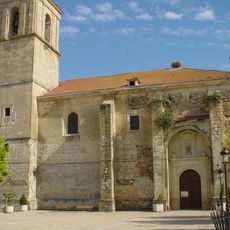
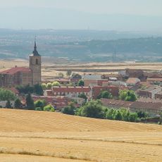
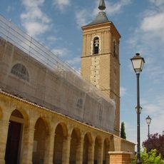
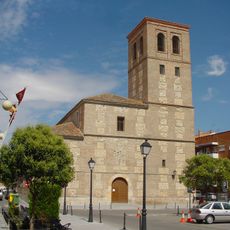
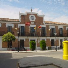
Paracuellos de Jarama, Municipality in northeastern Madrid, Spain

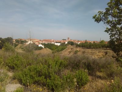
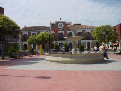
Paracuellos de Jarama is a municipality in northeastern Madrid, situated in a flat area that stretches between the capital and its major airport. The town functions as a residential community with local services and connections to surrounding regions.

The municipality experienced tragic events during the Spanish Civil War in 1936 that marked its history deeply. This period left lasting scars on the region's collective memory.

The name comes from the local fields, and today it serves as a residential area for families and commuters. People use this place as a base to travel to Madrid for work and daily activities.

The municipality has good bus connections to Madrid for daily commuting and getting around. Visitors can reach it easily by public transport and navigate the area on foot or by local services.

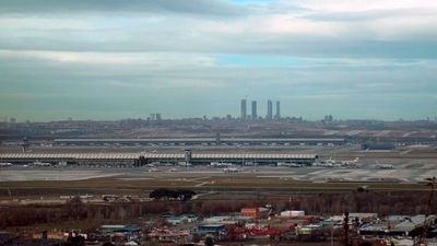
Its location near Madrid-Barajas Airport shapes daily life and brings aircraft noise to certain areas. This geographical feature creates a distinct experience that sets the place apart from other suburbs.

The community of curious travelers

AroundUs brings together thousands of curated places, local tips, and hidden gems, enriched daily by 60,000 contributors worldwide.

Start exploring
Capital city
Paracuellos de Jarama
Elevation above the sea
656 m
Part of
Mancomunidade do Leste, Mancomunidad «Servicio de Emergencias Mancomunado de Daganzo y Paracuellos» (S.E.M.)
Shares border with
Ajalvir, Torrejón de Ardoz, San Fernando de Henares, Madrid, Alcobendas, San Sebastián de los Reyes, Cobeña, Barajas
GPS coordinates
40.50472,-3.53000
Latest update
December 14, 2025 20:41
Reviews
Share your experience

No review yet

Discussions
Start a discussion...

No discussion yet

« Paracuellos de Jarama - Municipality in northeastern Madrid, Spain » is provided by Around Us (aroundus.com). Images and texts are derived from Wikimedia project under a Creative Commons license. You are allowed to copy, distribute, and modify copies of this page, under the conditions set by the license, as long as this note is clearly visible.

Discover hidden gems everywhere you go!

From secret cafés to breathtaking viewpoints, skip the crowded tourist spots and find places that match your style. Our app makes it easy with voice search, smart filtering, route optimization, and insider tips from travelers worldwide. Download now for the complete mobile experience.

Around Us App Screenshot

A unique approach to discovering new places

Le Figaro

All the places worth exploring

France Info

A tailor-made excursion in just a few clicks

20 Minutes

Around Us
Travel Guide & Maps
Download

Send to your phone

QR Code
1

Open the camera app on your mobile.

2

Point at the QR code with your camera. A notification will appear.

3

Tap the notification to open the link.