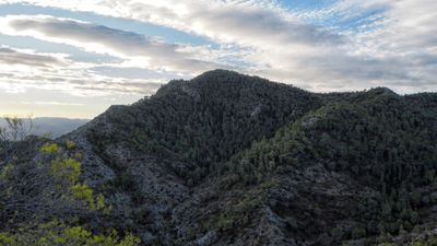
Mount Picossa, Mountain summit in Móra d'Ebre, Spain
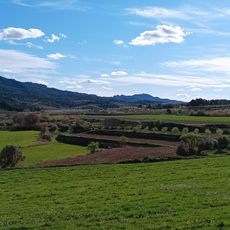
Mount Picossa is a summit in Móra d'Ebre that rises about 496 meters above the surrounding terrain. A triangulation station stands at its peak, and from there you can see across the landscape toward Serra de Cavalls.
The summit played a role during the Battle of the Ebro in 1938 when military forces operated in the region during their retreat. The elevation served as a strategic observation point during this period.
The peak represents a significant landmark in Catalonian geography, marking the boundary between the Ebro River valley and the Central Depression.
Climbing the mountain requires permits due to wildlife protection measures, particularly for nesting birds of prey in the area. Visitors should check these requirements before planning a visit.
The peak serves as a key reference point for mapping and surveying work across Catalonia, identified by its precise coordinates. This surveying importance makes it particularly valuable to geographers and cartographers.
The community of curious travelers
AroundUs brings together thousands of curated places, local tips, and hidden gems, enriched daily by 60,000 contributors worldwide.