Chest opened
+${chestReward.xp} XP
Explorer
NOUVEAU ×${chestReward.collectible.quantity}
tapez pour fermer

See the monuments around you in AR Open chests in the app

Around Us is built for your phone — point your camera at the streets and discover the monuments and places around you in augmented reality. Around Us is built for your phone — chests unlock when you walk, explore and capture nearby places.

•

Enable Location

We need your location to show you interesting places around you

Discover nearby places

Find interesting locations and hidden gems around you

Precise directions

Get accurate directions and distances to places

Your location is never shared with other users. It's only used when you tap the location button.

Omaha Beach

Log in to your account

Start exploring — it's free

Trusted by 92,215 travelers worldwide

Continue with Google
Continue with Apple
or

We will send you a code to connect

By continuing, you accept our Terms and Conditions and our Privacy Policy

Check your inbox

We've sent a pincode in your inbox. Please enter the code below.

Omaha Beach, WWII landing beach in Normandy, France

Omaha Beach is an 8-kilometre stretch of Normandy coast running from west of Sainte-Honorine-des-Pertes to east of Vierville-sur-Mer, divided by Allied planners into sectors from Charlie to Fox Red. A gently sloping tidal flat about 300 m wide lies below a shingle bank 2.5 m high, backed by a sea wall and bluffs 30–50 m tall cut by five wooded draws.

Omaha was the longest of the five Allied landing sectors, an 8 km stretch from Sainte-Honorine-des-Pertes to Vierville-sur-Mer. On 6 June 1944 the untested US 29th Infantry Division and Rangers took the western half, the 1st Infantry Division the eastern half, against the German 352nd Infantry Division. American forces suffered 2,400 casualties but landed 34,000 troops; the 352nd lost 1,200 men.

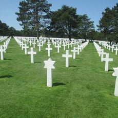
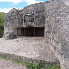
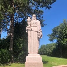
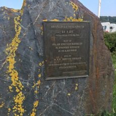
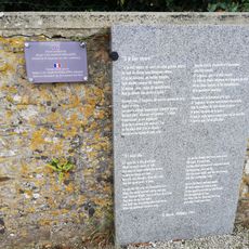
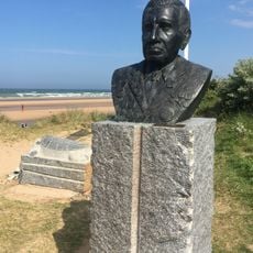
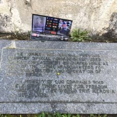
The beach is a place of remembrance, with monuments along the shore to the soldiers who fell on 6 June 1944. The German 352nd Infantry Division, defending the sector under Generalleutnant Dietrich Kraiss, lost about 1,200 men, a tenth of its strength, and received no reserves.

The beach is freely accessible year-round, and information panels along the shore help visitors understand what happened in different parts of the area. Comfortable shoes are a good idea, as moving between the shore, the memorials, and the nearby cemetery takes time on foot.

The names Omaha and Utah were probably suggested by Omar Bradley, as two privates fitting out his London headquarters came from Omaha, Nebraska (Gayle Eyler) and Provo, Utah. The sector was first designated X-Ray in the phonetic alphabet of the day and renamed on 3 March 1944.

The community of curious travelers

AroundUs brings together thousands of curated places, local tips, and hidden gems, enriched daily by 92,215 contributors worldwide.

Start exploring
Location
Part of
Beaches of the D-Day Landings, Normandy, 1944
Address
Omaha Beach, France
GPS coordinates
49.36553,-0.86205
Latest update
October 22, 2026 08:24
Reviews

Real people, real opinions — but not verified.

Share your experience
pat_riceqc
pat_riceqc · Jun 23
giorgio_66
giorgio_66 · Apr 15
stephren
stephren · Apr 11, 2025

A significant memorial site where one comes to honor all these young soldiers who died on our beaches in the name of freedom.

Discussions
Start a discussion...

No discussion yet

« Omaha Beach - WWII landing beach in Normandy, France » is provided by Around Us (aroundus.com). Images and texts are derived from Wikimedia project under a Creative Commons license. You are allowed to copy, distribute, and modify copies of this page, under the conditions set by the license, as long as this note is clearly visible.

Discover hidden gems everywhere you go!

From secret cafés to breathtaking viewpoints, skip the crowded tourist spots and find places that match your style. Our app makes it easy with voice search, smart filtering, route optimization, and insider tips from travelers worldwide. Download now for the complete mobile experience.

Around Us App Screenshot
❝

A unique approach to discovering new places❞

— Le Figaro

❝

All the places worth exploring❞

— France Info

❝

A tailor-made excursion in just a few clicks❞

— 20 Minutes

Around Us
Travel Guide & Maps
Download

Send to your phone

QR Code
1

Open the camera app on your mobile.

2

Point at the QR code with your camera. A notification will appear.

3

Tap the notification to open the link.