Enable Location

We need your location to show you interesting places around you

Discover nearby places

Find interesting locations and hidden gems around you

Precise directions

Get accurate directions and distances to places

Your location is never shared with other users. It's only used when you tap the location button.

Andrézieux-Bouthéon

Log in to your account

Start exploring — it's free

Trusted by 61,515 travelers worldwide

Continue with Google
Continue with Apple
or

We will send you a code to connect

By continuing, you accept our Terms and Conditions and our Privacy Policy

Check your inbox

We've sent a pincode in your inbox. Please enter the code below.

Andrézieux-Bouthéon

Andrézieux-Bouthéon, Administrative commune in Loire, France

Description

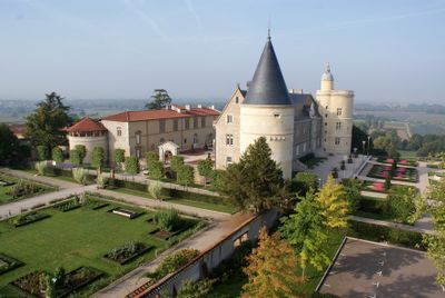
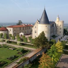
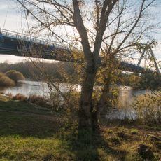
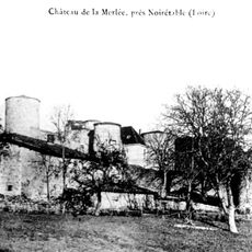
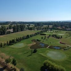
Andrézieux-Bouthéon is a commune in Loire located along the Loire River's right bank, near where the Furan joins it. The settlement spreads across the surrounding area and is characterized by the prominent Château Bouthéon that overlooks the valley.

History

The present-day commune was formed in 1968 through the merger of two settlements and grew with the industrial development of the Loire region. This union brought new economic opportunities that continue to shape local identity.

Culture

The Château Bouthéon shapes the local landscape and displays building methods from past centuries typical of the region. Visitors can observe here how local craftspeople applied traditional techniques in construction.

Practical

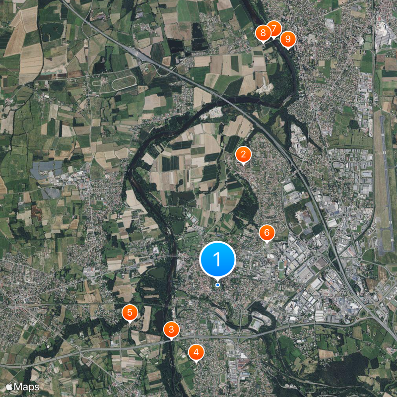
The location is well connected by direct bus services and roads to Saint-Étienne, which lies to the south and is easily accessible. Visitors find here a quieter destination away from major tourist crowds, with solid local infrastructure.

Did you know?

The village maintains sister city partnerships with towns in Germany, Portugal, England, and Italy. These international connections regularly bring visitors from those countries and encourage cultural exchanges between the communities.

Location
Inception
January 23, 1965
Elevation above the sea
390 m
Shares border with
Veauchette, Veauche, Bonson, La Fouillouse, Saint-Bonnet-les-Oules, Saint-Cyprien, Saint-Just-Saint-Rambert
Address
42160 Andrézieux-Bouthéon, France
Phone
GPS coordinates
45.52509,4.25948
Latest update
December 20, 2025 14:00

AroundUs brings together thousands of curated places, local tips, and hidden gems, enriched daily by 60,000 contributors worldwide. Discover all places nearby (Loire).

Things to see in Loire: castles, medieval villages, and must-visit natural landscapes

Between plains, dormant volcanoes, and deep forests, the Loire reveals a wealth of cultural heritage. Here, medieval castles stand alongside the wild landscapes of gorges and the Pilat massif, abbeys weave through hills and valleys, and fortified villages still carry the scent of the Middle Ages....

« Andrézieux-Bouthéon - Administrative commune in Loire, France » is provided by Around Us (aroundus.com). Images and texts are derived from Wikimedia project under a Creative Commons license. You are allowed to copy, distribute, and modify copies of this page, under the conditions set by the license, as long as this note is clearly visible.

Discover hidden gems everywhere you go!

From secret cafés to breathtaking viewpoints, skip the crowded tourist spots and find places that match your style. Our app makes it easy with voice search, smart filtering, route optimization, and insider tips from travelers worldwide. Download now for the complete mobile experience.

Around Us App Screenshot

A unique approach to discovering new places

Le Figaro

All the places worth exploring

France Info

A tailor-made excursion in just a few clicks

20 Minutes

Around Us
Travel Guide & Maps
Download

Send to your phone

QR Code
1

Open the camera app on your mobile.

2

Point at the QR code with your camera. A notification will appear.

3

Tap the notification to open the link.