Canal de l'Eure

Log in to your account

AroundUs is a community-driven map of interesting places, built by curious explorers like you. It grows with every review, story, and photo you share.
Connect to save your favorite spots, contribute locations, and create personalized routes.
Continue with Google
Continue with Apple
Continue with X
Continue with Facebook
Continue with email
By continuing, you accept our Terms and Conditions and our Privacy Policy
Create an account

Canal de l'Eure

Add to collection
Map
Suggest a change
Share

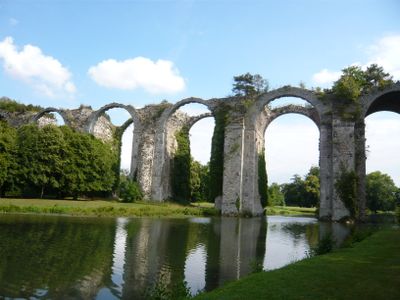
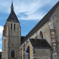
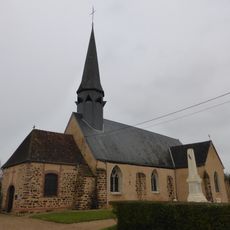
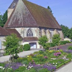
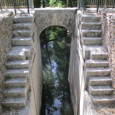
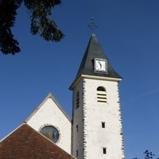
Canal de l'Eure, Engineering canal in Berchères-Saint-Germain, France

The Canal de l'Eure is a historic waterway built to carry water from the Eure River across the French countryside toward Versailles. Along its path stand stone aqueducts, earthen dams, water channels, and various structures designed to control and direct the flow.

Military engineer Vauban designed this waterway starting in 1685 on orders from King Louis XIV to supply water to Versailles. The ambitious project faced technical challenges and was never completed as originally envisioned, leaving behind the ruins visitors see today.

The waterway embodies royal ambition and shows how King Louis XIV sought to reshape the landscape to serve his palace. Walking along it today, you can understand the sheer scale of resources devoted to supplying water for Versailles' fountains.

Several sections of the original waterway remain accessible to visitors in the countryside around Berchères-Saint-Germain and nearby villages. Spring and autumn offer the best conditions for exploring, as the weather stays mild and vegetation does not hide the old structures.

The Digue de Boizard, an earthen storage dam, was an ingenious solution for holding water and shows the hydraulic knowledge of the 1600s. This structure remains visible today as proof of the engineering skill that went into the project.

Location: Berchères-Saint-Germain

Location: Pontgouin

Location: Maintenon

Location: Étang de la Tour

Location: Fontaine-la-Guyon

Location: Saint-Arnoult-des-Bois

Location: Bailleau-l'Évêque

Location: Chartainvilliers

Inception: 1685

GPS coordinates: 48.48770,1.13310

Latest update: December 10, 2025 16:24

Photos
Reviews

Visited this place? Tap the stars to rate it and share your experience / photos with the community! Try now! You can cancel it anytime.

« Canal de l'Eure - Engineering canal in Berchères-Saint-Germain, France » is provided by Around Us (aroundus.com). Images and texts are derived from Wikimedia project under a Creative Commons license. You are allowed to copy, distribute, and modify copies of this page, under the conditions set by the license, as long as this note is clearly visible.

Discover hidden gems everywhere you go!

From secret cafés to breathtaking viewpoints, skip the crowded tourist spots and find places that match your style. Our app makes it easy with voice search, smart filtering, route optimization, and insider tips from travelers worldwide. Download now for the complete mobile experience.

Around Us App Screenshot

A unique approach to discovering new places

Le Figaro

All the places worth exploring

France Info

A tailor-made excursion in just a few clicks

20 Minutes