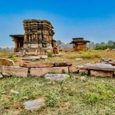
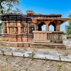
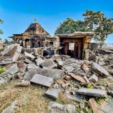
Guna district, Administrative district in Madhya Pradesh, India
Guna district is an administrative division in central India within the Gwalior region, shaped by river systems and varying terrain. The landscape encompasses agricultural plains and rural communities scattered across its territory.
The area remained under Gwalior rule for centuries until India's independence in 1947, after which it became part of Madhya Bharat state. This shift ended the previous feudal arrangement and integrated the territory into the new national framework.
The population of Guna district includes a majority of Hindu residents at 94.42 percent, followed by smaller communities practicing Islam and Jainism.
The district is best explored from its regional centers, as road connections are concentrated along main routes linking surrounding areas. Visitors should know that this is a thinly populated agricultural region, so advance planning helps when traveling through.
The territory sits at roughly 474 meters elevation and serves as a geographic threshold between the distinct landscape regions of Malwa and Chambal. This elevation position has traditionally influenced local weather patterns and farming approaches in the area.
The community of curious travelers
AroundUs brings together thousands of curated places, local tips, and hidden gems, enriched daily by 60,000 contributors worldwide.