Enable Location

We need your location to show you interesting places around you

Discover nearby places

Find interesting locations and hidden gems around you

Precise directions

Get accurate directions and distances to places

Your location is never shared with other users. It's only used when you tap the location button.

Radstädter Tauern Pass

Log in to your account

Save your favorite places
Create custom travel routes
Rate and review places
Access the full interactive map
Continue with Google
Continue with Apple
Continue with email
By continuing, you accept our Terms and Conditions and our Privacy Policy
Create an account

Radstädter Tauern Pass

Add to collection
Map
Suggest a change
Share

Radstädter Tauern Pass, mountain pass

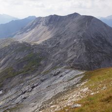
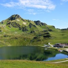
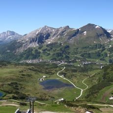
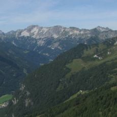
Radstädter Tauern Pass is a mountain crossing in the Alps of Salzburg that sits at around 1,738 meters (5,700 feet) and connects the Pongau valley near Radstadt with the Lungau valley toward Mauterndorf. It runs through the Niedere Tauern range and separates two mountain groups with steep slopes and rocky terrain on both sides.

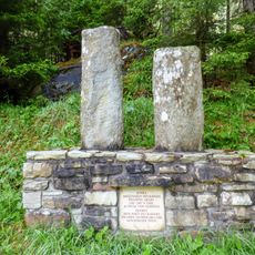
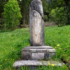
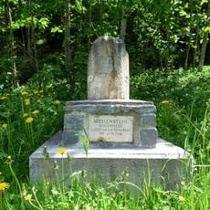
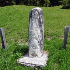
The Romans used a route over this pass and built a reinforced road with large stone slabs that still influences travel routes today. It served as a key trade route that allowed goods like salt and metals to be transported across the Alps.

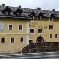
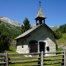
The pass takes its name from the nearby town of Radstadt, which grew around this mountain crossing. Today visitors can see at the stone markers and old road remains how this place has connected people and attracted passing merchants for centuries.

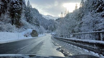
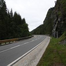
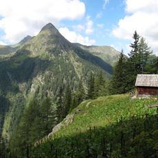
The pass is best reached via the Katschbergstraße road, which runs from Radstadt to Mauterndorf and offers a slow, winding drive through the mountains. Visitors should be prepared for rapidly changing weather conditions, as snow or rain can make the road slippery.

Along the old Roman road, visitors can still see milestone stones with carved marks today that show how the Romans marked distances and demonstrated their control over this mountain pass centuries ago. These stones tell a story of ancient travel and Roman engineering skill.

Location: Salzburg

Elevation above the sea: 1,738 m

Address: Radstädter Tauern Pass, 5562 Obertauern, Austria

GPS coordinates: 47.24799,13.55926

Latest update: January 26, 2026 13:54

Photos
What to see in the Salzburg region: baroque city, mountain lakes, villages of Salzkammergut

The Salzburg region includes mountain landscapes, villages by turquoise lakes, and a city listed as a UNESCO World Heritage Site. The area stretches from the shores of Salzkammergut, where mountains are reflected in the lakes, to the snowy peaks of Pinzgau and high-altitude parks. Between these, the...

Reviews

Visited this place? Tap the stars to rate it and share your experience / photos with the community! Try now! You can cancel it anytime.

« Radstädter Tauern Pass - mountain pass » is provided by Around Us (aroundus.com). Images and texts are derived from Wikimedia project under a Creative Commons license. You are allowed to copy, distribute, and modify copies of this page, under the conditions set by the license, as long as this note is clearly visible.

Discover hidden gems everywhere you go!

From secret cafés to breathtaking viewpoints, skip the crowded tourist spots and find places that match your style. Our app makes it easy with voice search, smart filtering, route optimization, and insider tips from travelers worldwide. Download now for the complete mobile experience.

Around Us App Screenshot

A unique approach to discovering new places

Le Figaro

All the places worth exploring

France Info

A tailor-made excursion in just a few clicks

20 Minutes