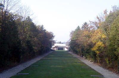
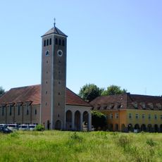
Stadtfriedhof Linz /St. Martin, Cemetery and park area in Traun, Austria
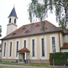
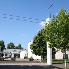
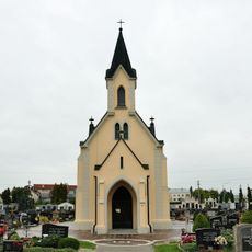
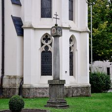
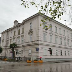
Stadtfriedhof Linz is a large burial ground in Traun with individual graves, urn sites, and memorial areas spread across an extensive landscape. The grounds feature multiple farewell halls and chapels, with different sections designed to accommodate various burial traditions.
The cemetery began construction during World War II in 1943, with burials starting in 1945 and entrance buildings completed years later. This timeline reflects how the site developed to meet needs across different historical periods.
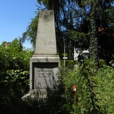
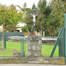
This cemetery serves as a spiritual space for different religions and communities, with dedicated sections for Islamic burials, Soviet prisoners, and victims of concentration camps. You can see how diverse cultures and histories are honored side by side in a respectful setting.
The grounds adjust their access times based on seasons, opening earlier and staying open later during warmer months and closing earlier in winter. Clear pathways make it easy to navigate the different sections when visiting.
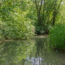
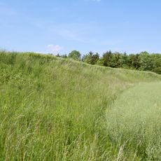
The grounds offer a special program called Natura in memoriam that allows nature-based burials near water features. This concept blends remembrance with environmental care in a distinctive way.
Location: Traun
Address: Wiener Bundesstrasse 101
GPS coordinates: 48.23876,14.24769
Latest update: December 14, 2025 18:43
Schloss Traun
2.4 km
Autobahnkirche Haid
3.8 km
Stadtpfarrkirche Traun
2.1 km
Johanneskirche (Linz)
3.5 km
St. Isidor
3.1 km
Pfarrkirche Guter Hirte
3.5 km
Pfarrkirche Langholzfeld
758 m
Pfarrkirche Leonding-Doppl
1.6 km
Pfarrkirche Traun-St. Martin
1.1 km
Pfarrkirche Leonding-Hart
3.1 km
Evangelische Pfarrkirche Traun
1.6 km
St. Franziskus
2.8 km
Ansfelden City Library
3.8 km
Basis-Endpunkt Neue Heimat
2.6 km
Traunauen bei St. Martin
2.4 km
Kinderdorfanlage St. Isidor
3.1 km
Überreste der abgekommenen Kirche St. Dionysen
1.7 km
Friedhofskapelle
1.7 km
Kath. Pfarrkirche Haid, ehem. Autobahnkirche (Teil in der KG Kremsdorf)
3.8 km
Bildstock
2.1 km
Pfarrhof von St. Dionysius
2.1 km
Schulzentrum Harter Plateau
3.2 km
Kath. Pfarrkirche Haid, ehem. Autobahnkirche (Teil in der KG Rapperswinkel)
3.8 km
Pfarrzentrum
701 m
Niederterrassenböschung in Traun
2.3 km
Volksschule Traun, Linzerstraße 7
2.1 km
Kindergarten und Pfarrhof
740 m
Volksschule
804 mVisited this place? Tap the stars to rate it and share your experience / photos with the community! Try now! You can cancel it anytime.
Discover hidden gems everywhere you go!
From secret cafés to breathtaking viewpoints, skip the crowded tourist spots and find places that match your style. Our app makes it easy with voice search, smart filtering, route optimization, and insider tips from travelers worldwide. Download now for the complete mobile experience.
A unique approach to discovering new places❞
— Le Figaro
All the places worth exploring❞
— France Info
A tailor-made excursion in just a few clicks❞
— 20 Minutes